IN WHICH GARY AND I HAD PLANNED TO DO A LONG OLD RUN AND HIKE AROUND LEITRIM, AND THE IRISH WEATHER SAID ‘HOLD MY BEER…’
Sunday was the last day of Summer, according to the met folk. And in fairness to them, they had also accurately predicted the weekend’s weather. Gary and I had hatched a plan a while ago to have one last hurrah before the clocks go back and the council take the roads in for the Winter. After some mulling over a few options, we had plumped for a route around Leitrim near the Sligo border. It would have meant a full day out and about with a minimum of 80k ahead of us. But the weather was rather ugly, alas, and so with a few days to go, we pulled the plug.
Rather than write off the whole weekend, we threw a few Dublin/Wicklow route options around until Gary pitched the Lough Ouler Loop, and that was settled. So instead of spending Saturday horsing around the north-west, we headed out early-doors on Sunday morning for a much quicker spin; the nasty weather front had already passed on eastwards to do its worst elsewhere. With the Lough Ouler Loop clocking in at about 8k, it was going to be a tenth of the distance. Hence the blog title. All of those Latin and History classes were not wasted on me, no sirree!

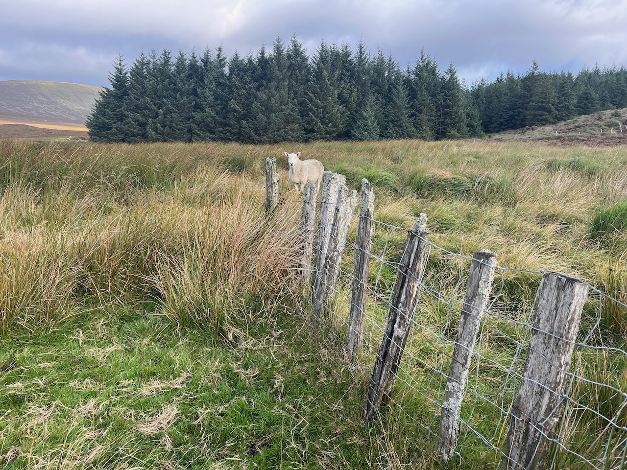
As hikes go, the loop in question packs a lot in over a short space. For a start, you can approach the trailhead from either Sally Gap or Laragh, and both are lovely routes. We chose Laragh, which gives you the perfect view of Glenmacnass Waterfall and valley. On the way, we crossed over the Wicklow Way as it winds up from Glendalough. The car park was already quite busy when we arrived at about 8am, though we didn’t really see anyone out and about until we were nearly home; we suspect most folks were doing the linear out and back route.
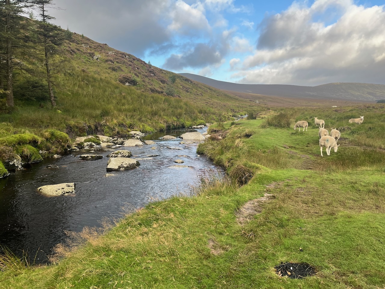
The first kilometre and a half or so brings you along the Glenmacnass Stream above the waterfall. This pretty little peaty river joins the Avonmore in Laragh Village, which is then joined by the Avonbeg in the Vale of Avoca to form the Avoca River. At some point, you must cross this stream, and Gary plunged on ahead on the basis that we were going to get our feet wet anyway, so we may as well get it over with. As we emerged from the water, we spied a perfect fording place with ideal boulders a few yards upstream… oh well…

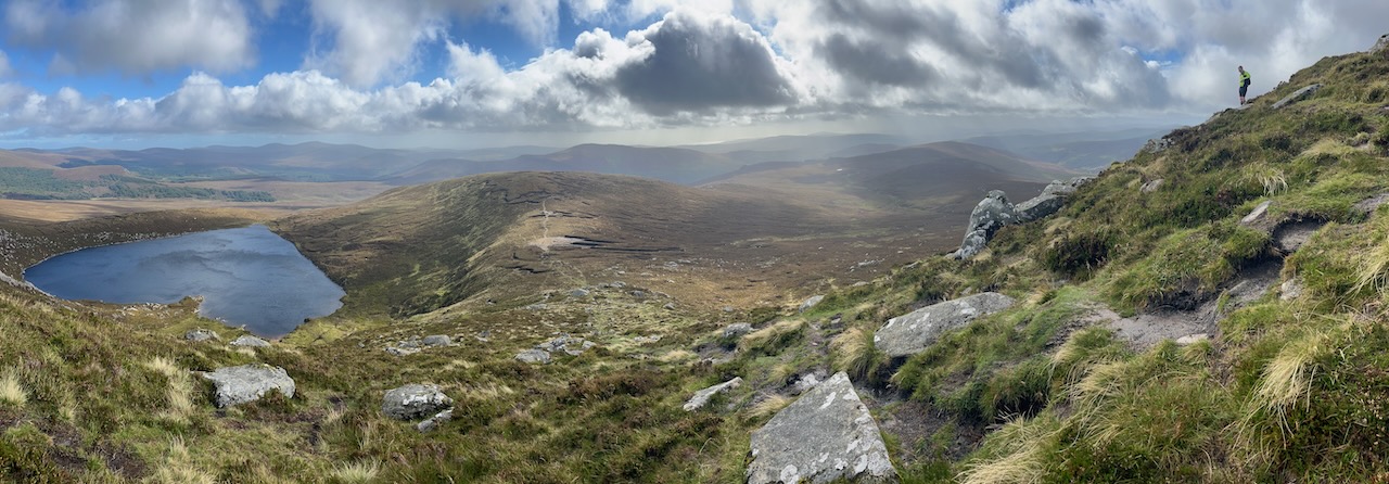
Ahead in the distance was a ridge with a small saddle down which a rivulet had carved a visual clue for us to follow. There was a path of sorts too, which the downloaded map confirmed was the way to go. Onwards and upwards, then, towards the saddle, with a fresh wind in our faces, and a pair of Ravens for company.
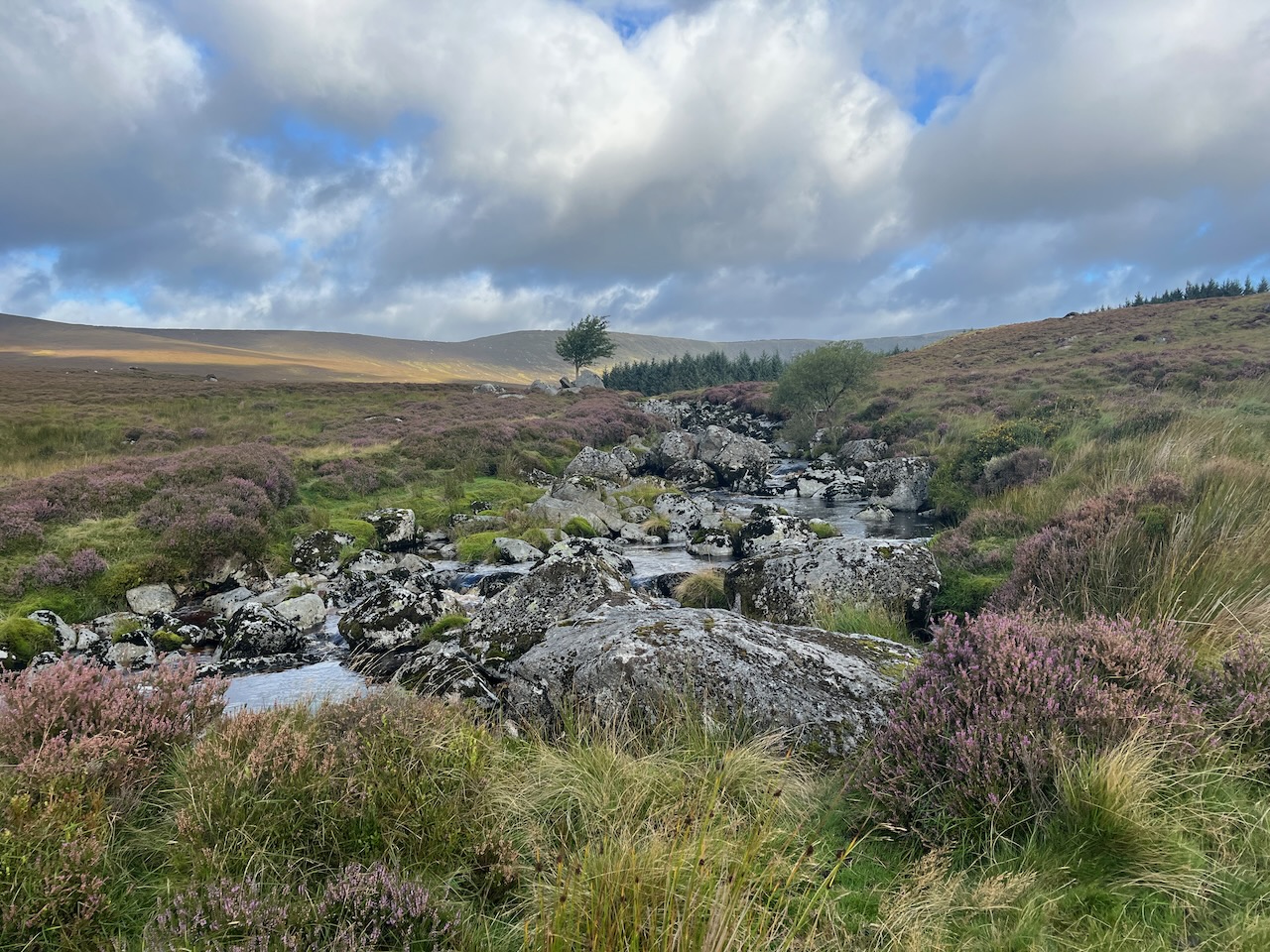
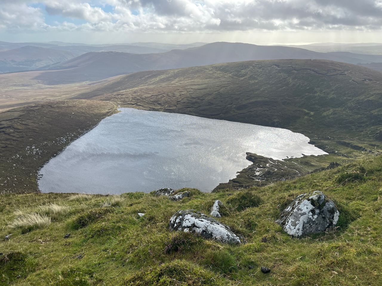
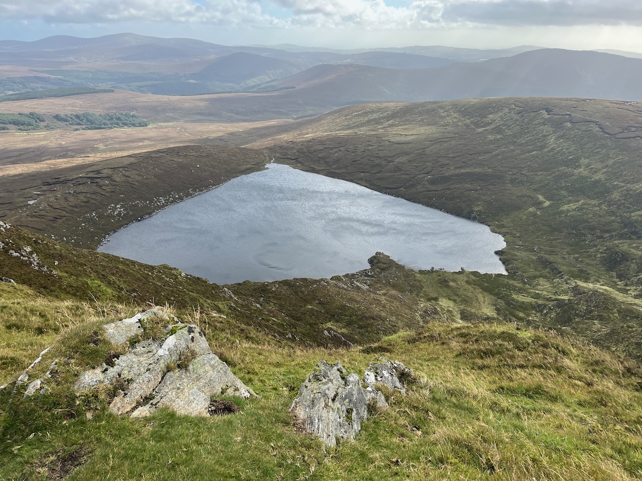
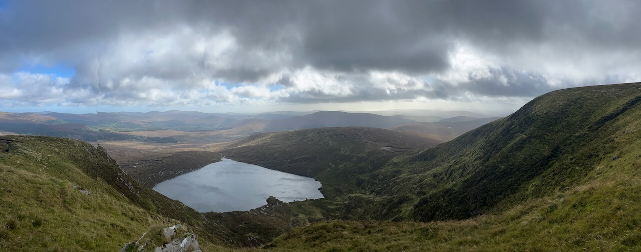
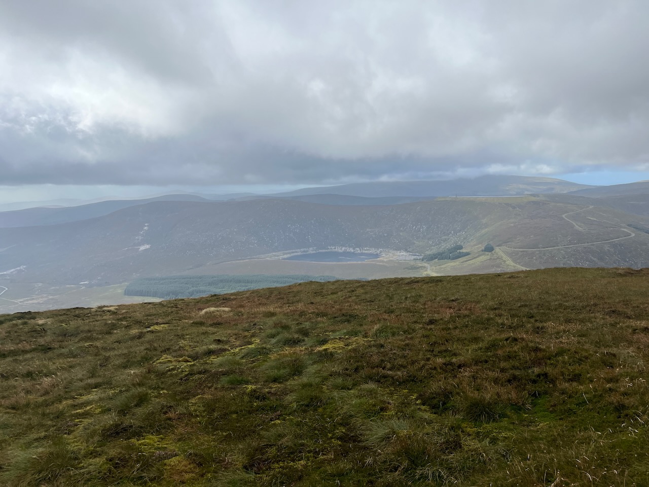
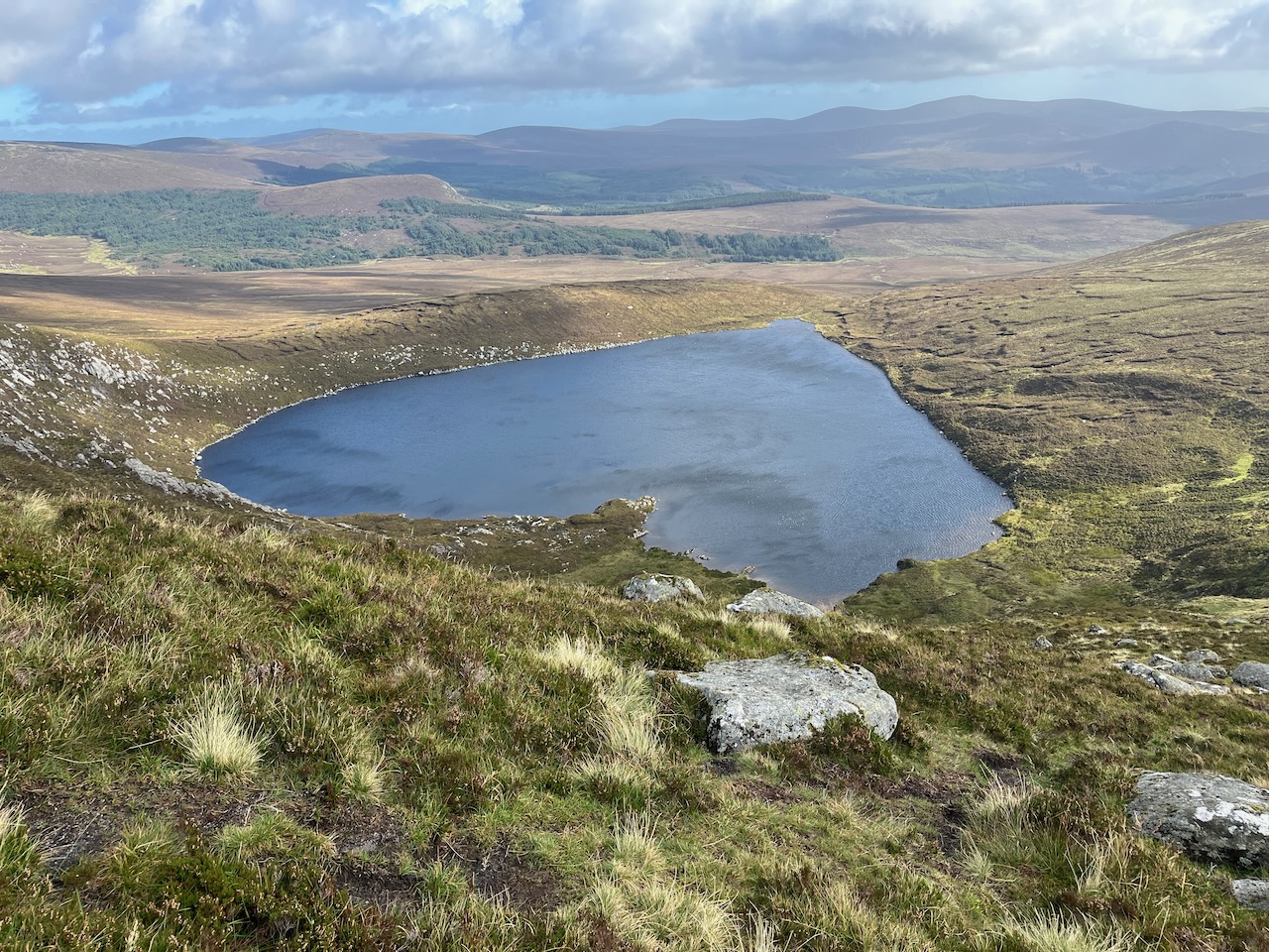
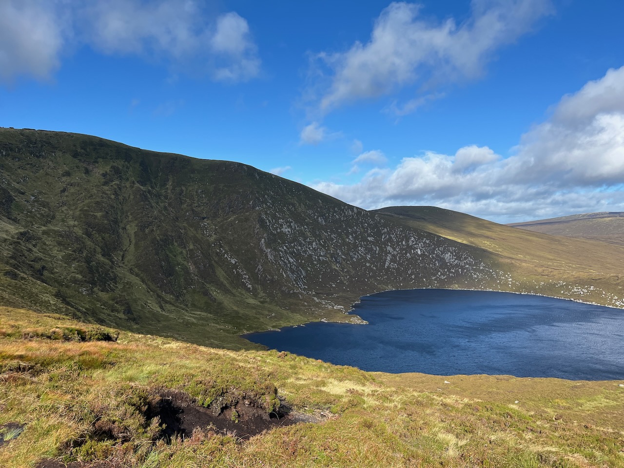
The top of the ridge was reached at about the three kilometre mark, and the ground levelled off in front of us, with the impressive face of Tonelagee now in sight. I knew the Lough would come into view shortly. Within a minute, we were standing at the head of the little stream we had followed, and we stopped for a snack to reward our efforts.
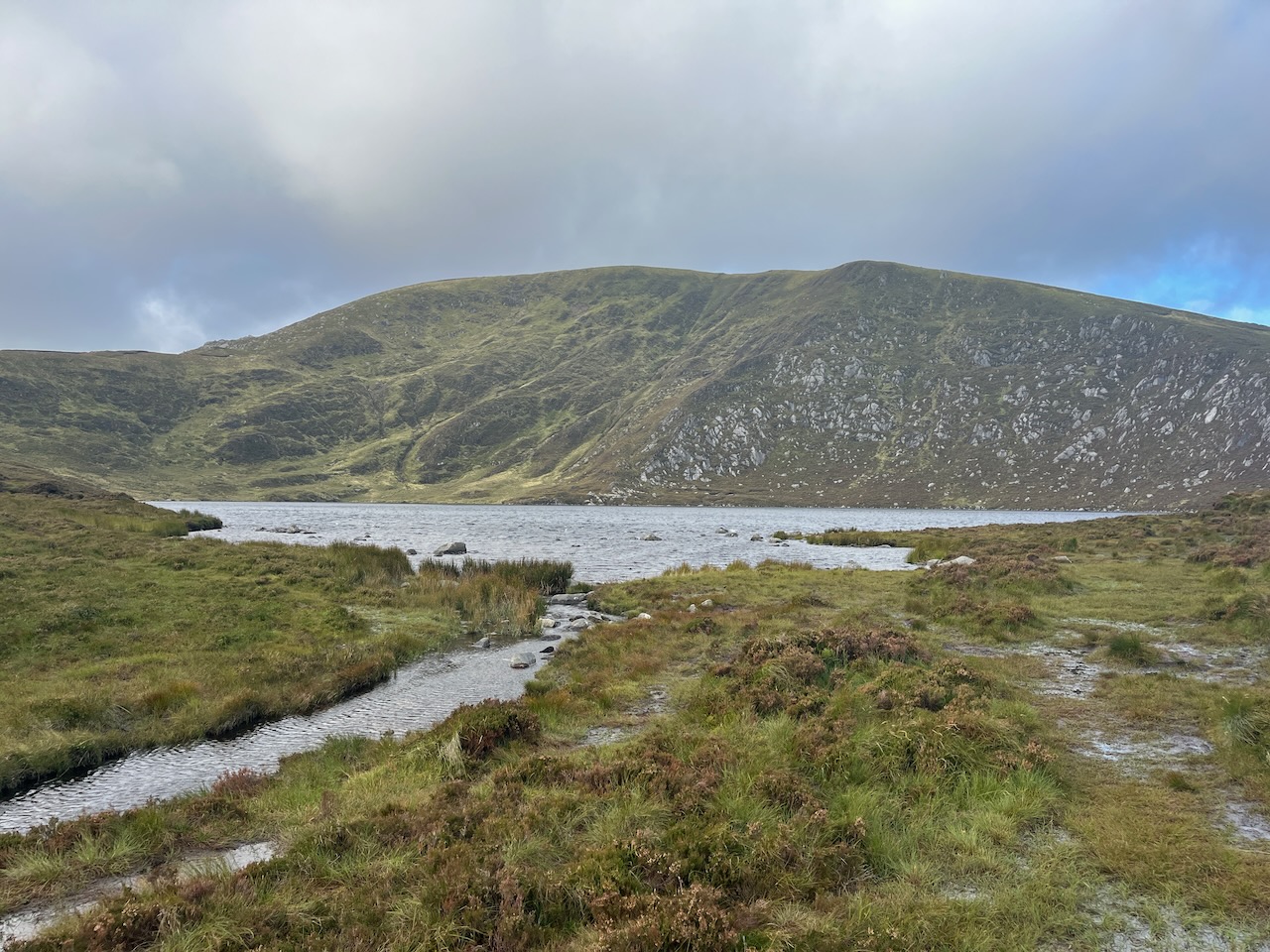
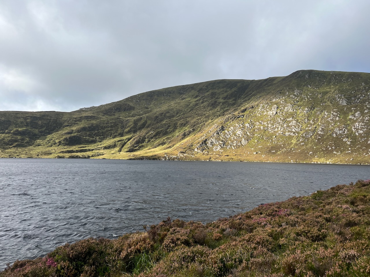
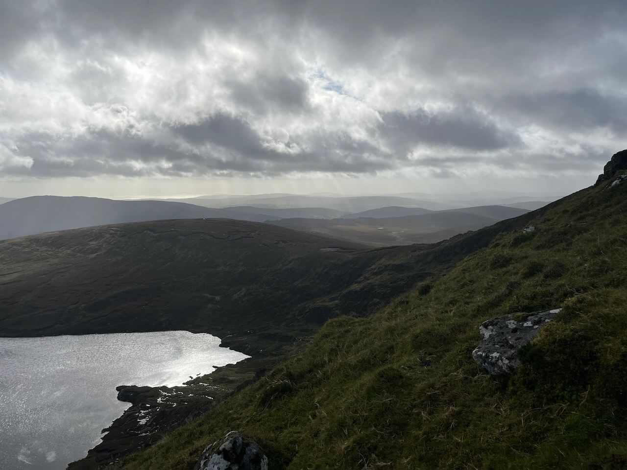
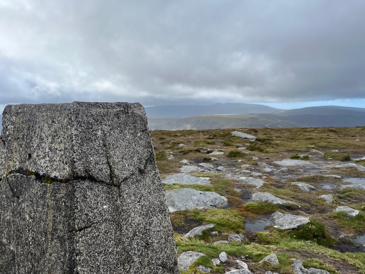
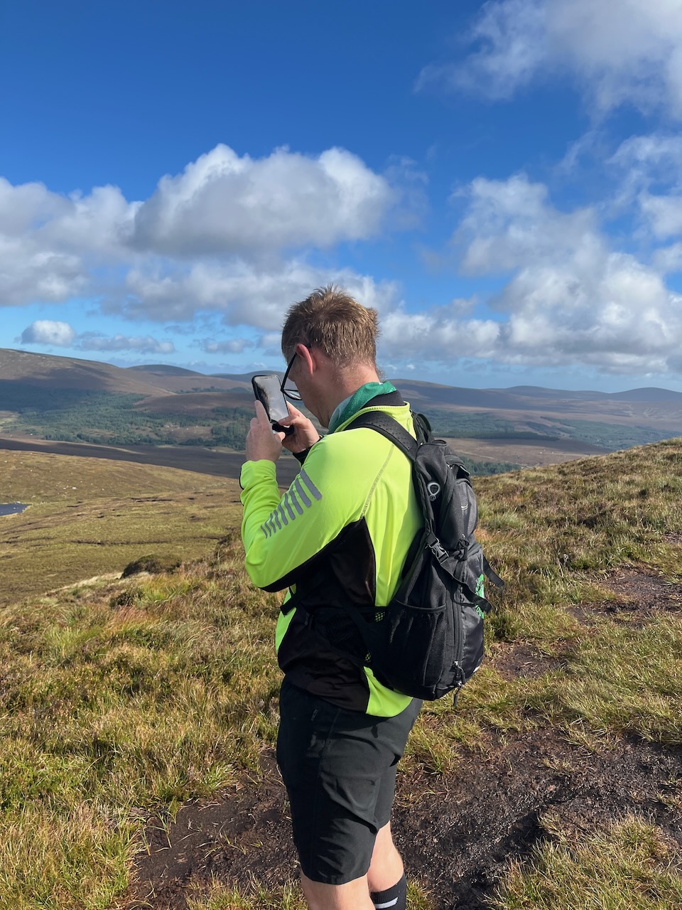
Then it was on to a more strenuous climb as we took on the right flank of the mountain that holds the heart-shaped corrie lake in its cold embrace. Up and up we climbed, and the wind grew stronger, so I removed my cap before the elements took that decision out of my hands. Sure enough, as we reached the summit of Tonelagee, the wind was hugely impressive, as was the view. To our north-east behind us was the sheer drop to the lake, and south-west offered splendid views over the Wicklow Gap and beyond. The engineering marvel that is Turlough Hill was clear to see. Check out the details of this power station with this link. Lough Ouler had made the short list as an option but I am glad they chose to leave it alone.
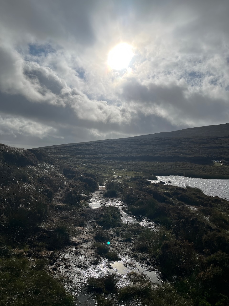
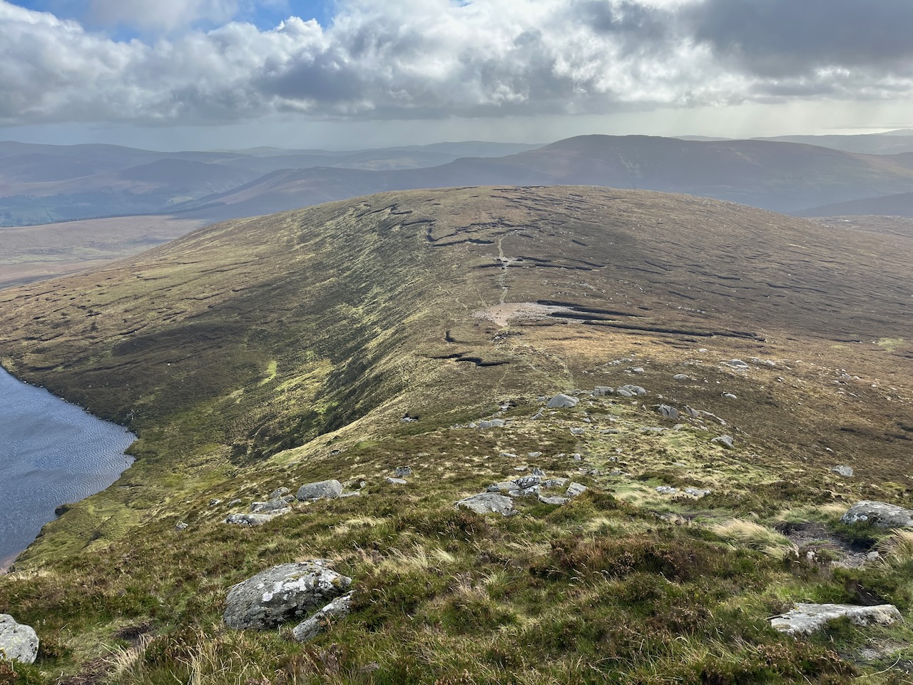
With the trig point ceremoniously touched, we could begin our descent. The route back is reasonably clear as it is a more popular route, but it was still possible to wander off the beaten path. Gary’s keen eye for a map made sure we navigated our way back to the car park without too much difficulty. Though the peaty mud made for a few slips all the same; my footwear choice had not been as wise as Gary’s, and even with the hiking poles, there were a few skiddy moments.


Our arrival at the car park just before 11am coincided with a large group of trail runners who were taking on Mullaghcleevaun as a part of an organised trail run; a twenty kilometre journey, or thereabouts. I think part of us would have fancied it, but we both had things to do back home, so we stopped off in a little café in Laragh for sausage rolls and tea, and then headed on our way. All told, a very pleasant hike, even if it wasn’t quite the epic adventure we had planned.
(For the Irish scholars out there, you will have noticed that Tonelagee in its original native form would be Tóin le Gaoith, which means ‘arse to the wind’. Quite apt.)
For the record, the weather in Leitrim the day before had indeed been fairly brutal, and we would have endured four hours or more of torrential showers. A wise decision in the end.
But we are lucky indeed to have this amazing spot on our doorstep. One hour’s drive from here can get you into the heart of the mountains, and some lovely loops. So if the weather is kind, we’ll get up again before the year is out.


That first joke up above is perhaps my finest Dad-joke moment. Even Tamsyn was impressed. Well, I think she was… That last one caught my eye the other night in the pub… there is a special place in hell for those that cast around apostrophes like snuff at a wake.

I got drenched out on the bike on Saturday morning and I was hoping you had decided that discretion was the better part of valour. Sounds like you had a good alternative though and you never know, you could get an opportunity in September?
LikeLiked by 1 person
Yes, we figured this wasn’t a race we had trained for, or a big event. It was supposed to be a fun adventure. Here’s to some settled weather!
LikeLiked by 1 person
Are you sure that what you took to be Lough Ouler wasn’t really an early sketch of a stealth jet? I believe that The Dubliner’s are thinking of suing over their missing apostrophe.
LikeLiked by 1 person
The Irish word Ouler could be from Iolar, which is an eagle, so it’s nice to believe that eagles once soared over the surroundings, and may do so again one day. And it fits with your jet suggestion 😉
Another theory suggests it may derive from the Irish for floor on the basis that the lake’s surface is generally quite calm as it is surrounded by steep cliffs from the prevailing winds.
As for the apostrophe… it’s bizarre indeed that the layout person would ignore the first opportunity to mess up, but then seize the next two with abandon!
LikeLiked by 1 person
Soooo lovely.
LikeLiked by 1 person