
‘Saint Declan’s Way is a pilgrim walking route linking Cashel in County Tipperary and Ardmore in County Waterford. It follows the route that Declan took when going to Cashel to meet Saint Patrick in the fifth century. In turn, it is the way that Pilgrims have taken to visit Saint Declan’s monastery, holy well and grave in Ardmore for the past one and a half thousand years.’
St. Declan’s Way Official Website
Thus begins the description on the official website. In fairness, when you dig a little deeper into the history of the route, you can see that this is no facsimile of some ancient path, preserved for all time. Rather, it is a curate’s egg; some good, some bad, and assuming my namesake did travel frequently from Ardmore to Cashel and back, I think we can safely agree that he didn’t do so on some of the sections that form the Way today. That said, there are a substantial number of religious sites along the route which no doubt attracted travellers on their pilgrimages, and the existence in old texts of such charming path names as St. Declan’s Road, Casán na Naomh (path of the saints), Bóthar na Naomh (road of the saints) and the Rian Bó Phadraig (track of St. Patrick’s cow) points to a good level of authenticity.
The committee had to move with the times, needless to say, so there are numerous occasions where the Way spits you out onto a busy road for a brief spell before taking back on to a quiet country lane. But their attempts to join these historical landmark ‘dots’ with suitable ‘lines’ is admirable, and it has produced a route of 115k that offers a lot to pilgrims and hikers alike.
And nutty ultra-runners.
And we should not forget the modern demands from the busy tourist that have produced what are referred to as ‘tea and pee’ attractions, which is to say: sure, I can come and see your holy stone/ring fort/cliff walk/<insert as appropriate>, but I need to know beforehand that I can do the quick tour and also spend some quality time in the cafeteria – there must be nice scones – and empty my bladder in a shiny facility. Also, is there a gift shop? I’m not really sure why I bring this up, other than this ‘needy tourist’ schtick bugs me, and also to quietly mention that if you are looking for a loo on the Way, you may be waiting a while. Don’t forget, you’re a pilgrim 😉
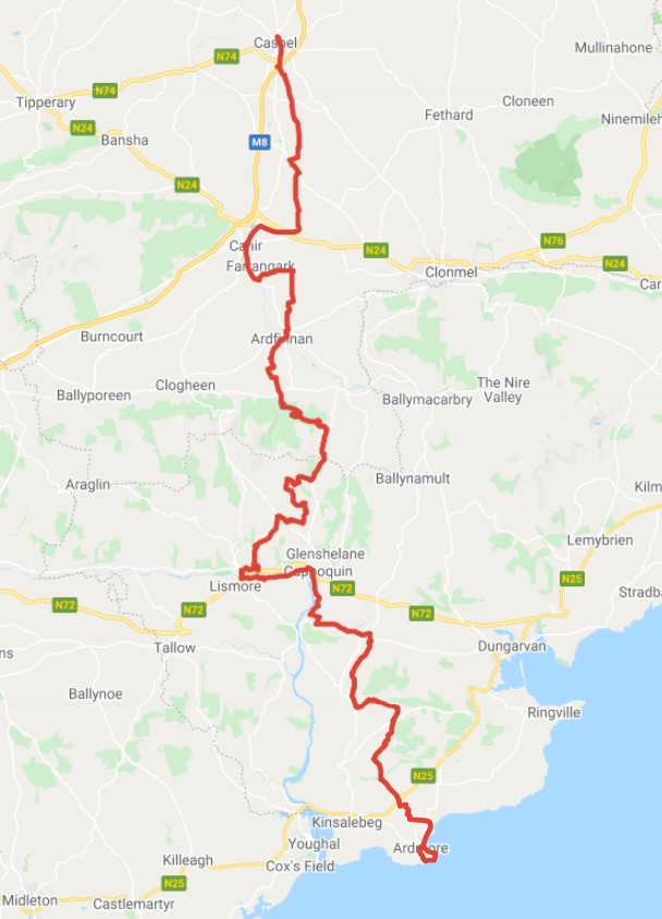
I’ve robbed the maps from the website. No point reinventing the wheel.


Just to finish the point about this particular attraction and its offerings as a tourist ‘destination’: it’s designed to be rambled in five days, taking in between 20 to 30 km per day. It is certainly not something anyone thought of doing as a through-hike/run in a single day, I’m guessing. I am not an expert on pilgrimages, but I suspect there should be a degree of – if not suffering – at least discomfort. Or, damn it, at least a feeling that you have travelled. Doing the route in one day may add to your discomfort, but clearly it removes some of that sense that you have ‘journeyed’. But that was my choice. Just thought I’d make that distinction. And finally, on the question of authenticity, we can all agree that this pilgrim path has a lot more going for it than, say, a marketeer’s dream like the Wild Atlantic Way.
For those three readers who have been following progress on this event, the last few weeks of build up were uneventful. I cut back on the running in true taper fashion, and in the last week, did none at all. Perhaps I overdid it in under doing it.
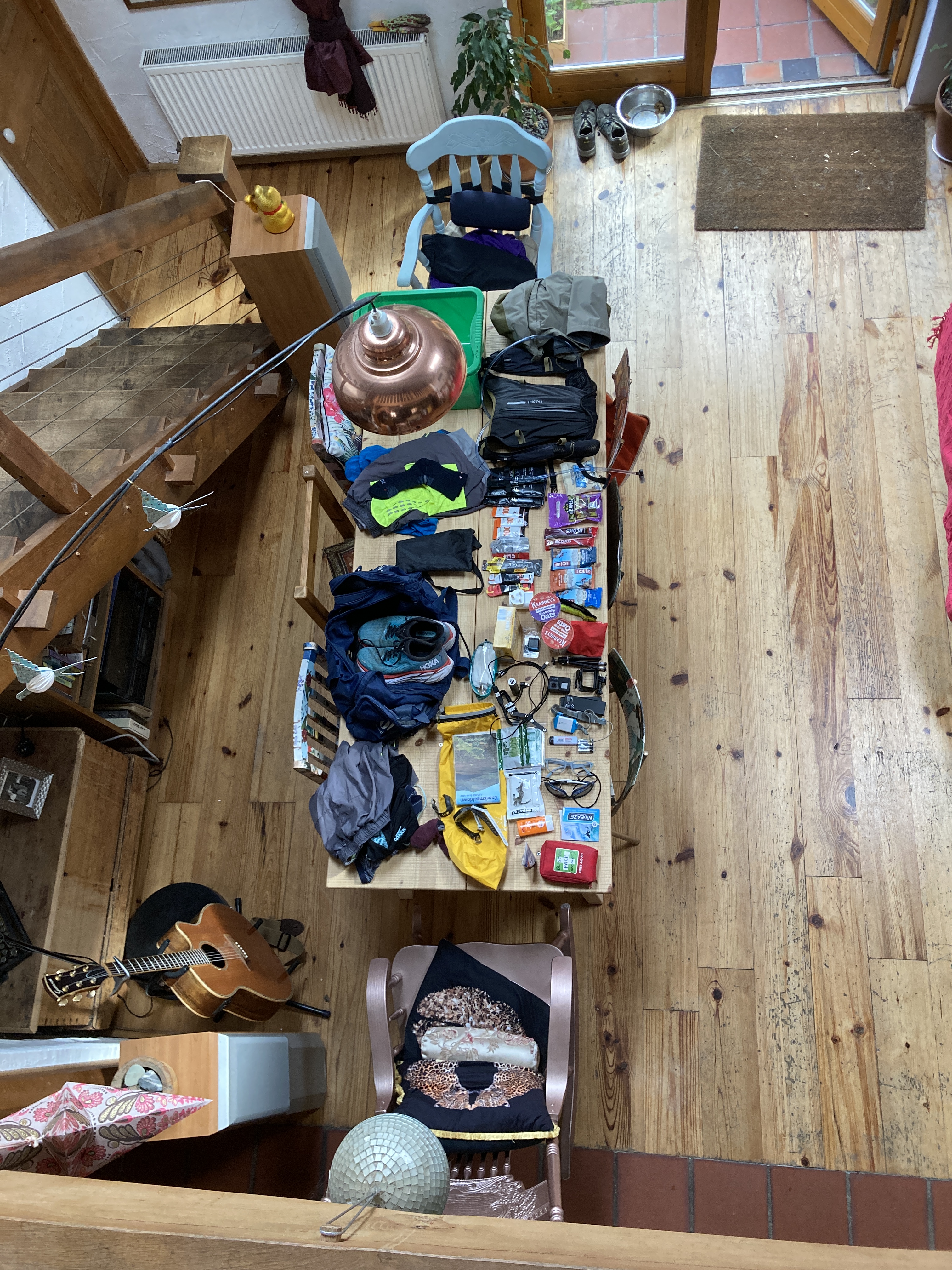
By Friday evening, the gear had all been gathered together in one spot. I would be using an Evadict 15L trail running bag from Decathlon. I’m not shilling for the company; I’ve no vested interest here, pardon the tenuous pun. They just offer a bit of value over the big, well-known brand names, plus the store is easy to get to from my house. Anything for a quiet life!

My running buddy and all-round decent bloke Mark would be getting me down to Ardmore where I would check into the hotel and leave my car. Then he would bring me to Cashel where I would again check in, and we would have some food before he left me to my own devices. I have no doubt had Gary been on the continent, he would have pitched in, but he is taking a well-earned holiday with Niamh, so I’ll hit him up on the next one 😉
The journey down was uneventful. After about two and a half hours, we pulled into the seafront car park at Ardmore. Here was the ‘finish line’, as such. I had Street Viewed this a few times, so it was an odd feeling to be finally looking at the three dimensional version of it. A tea break followed, and then we left my car behind and headed back up to Cashel. My plan was to treat Mark to a nice meal in this busy little town, but anywhere decent was booked out, so we ended up in the local chipper.
The final part of the puzzle was to get changed into my running gear and leave anything for home in Mark’s car. Once I checked into the B&B, I would have to carry anything I had with me on the run, or leave it behind. The owner was an ebullient French lady who bustled around the place with great gusto. Like others on this journey, she too thought it was all mad, but hey, if I wanted to pay to stay at her place for a few hours and miss out on breakfast, that was my look out.
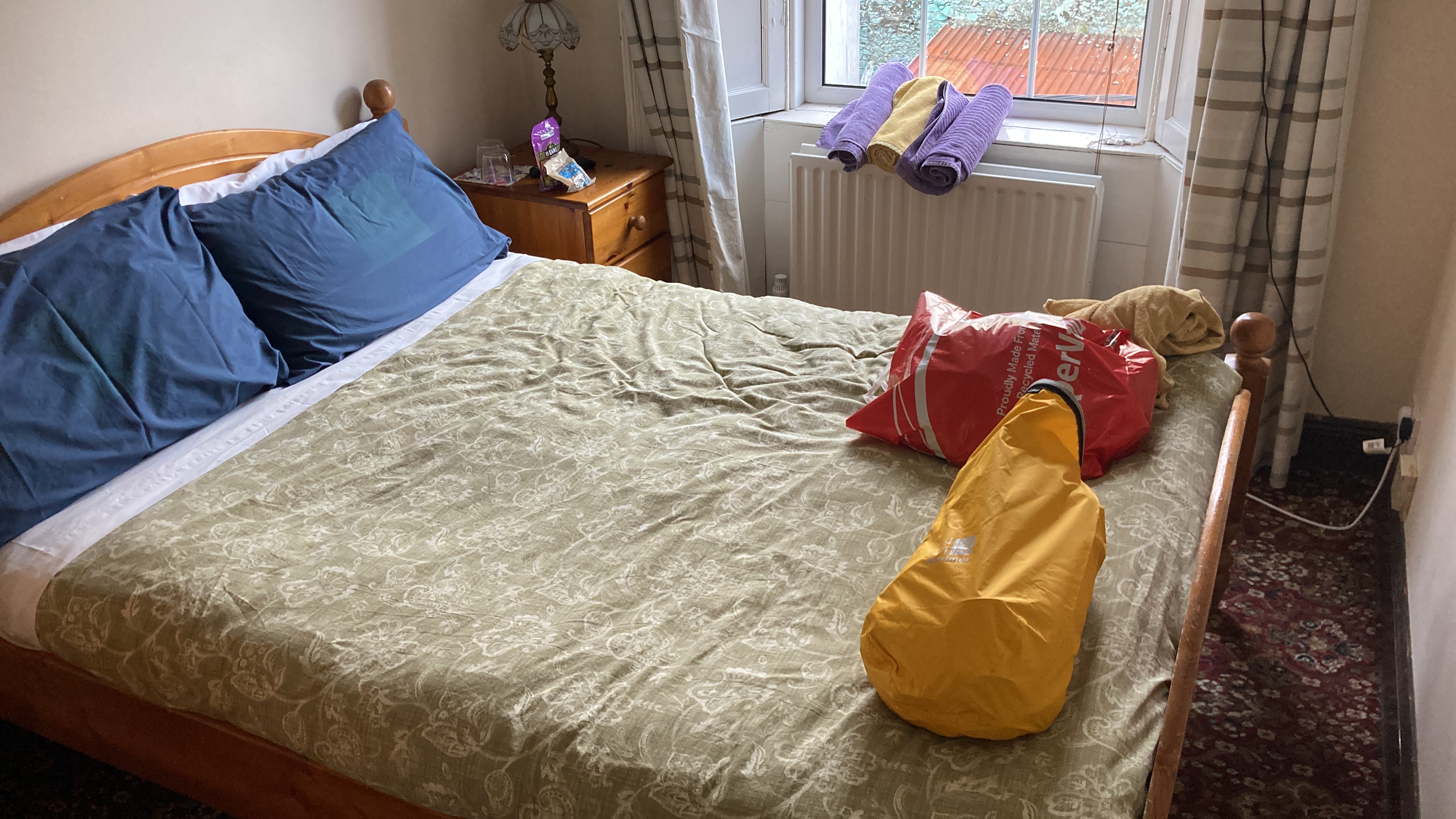
Up in the room, I sorted out the gear one last time. I snacked on a few bits and watched some football on the TV, and started to doze off. It was time to hit the hay. The gear was all laid out for an early start, though the weight of the bag was a concern. Still, everything in there was required. Or, put it another way, you could have ditched something at the last minute and regretted it at some stage. I chose to be a pack mule with options, rather than a slimmed down racehorse (!).
I was rudely woken at 2.30am by some very drunk and rowdy guests who started a very animated conversation out on the pavement, and then continued verbal sparring all the way up the stairs and into the bedroom beside me. I dozed again, then woke before the alarm about 4.30am and decided I may as well get up. Good news for my neighbour; I could hear heavy snoring rattling through the walls.
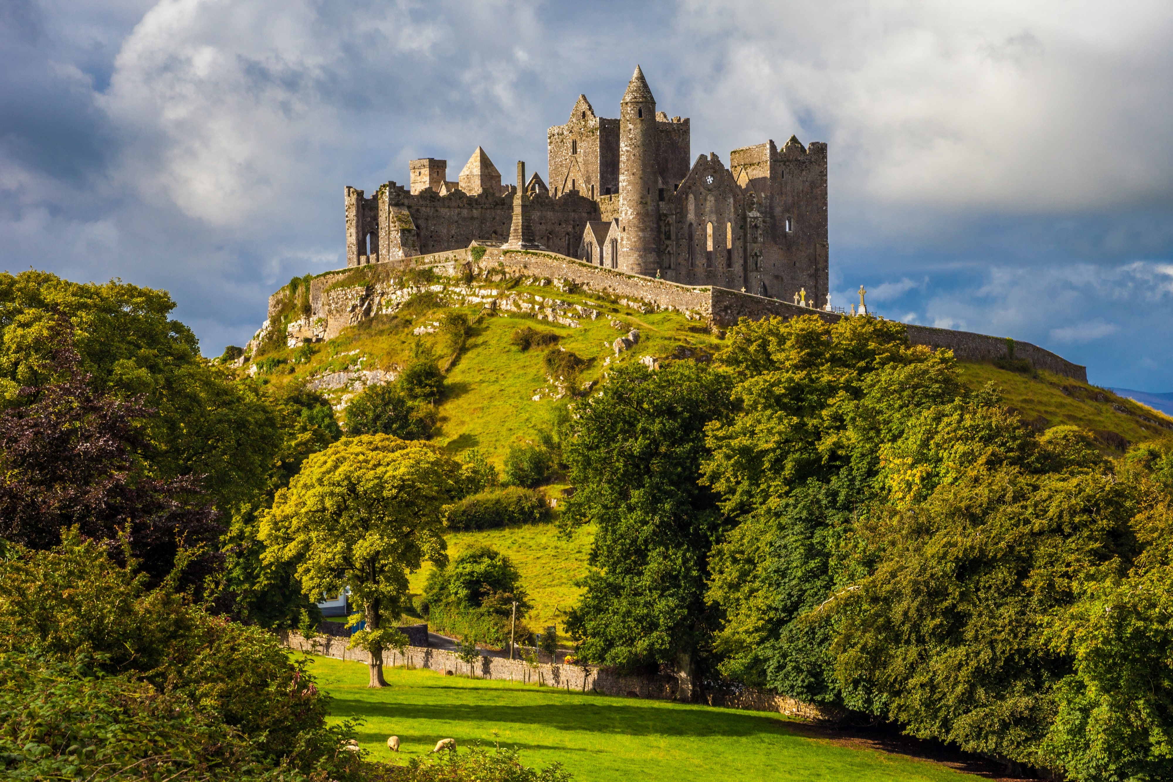
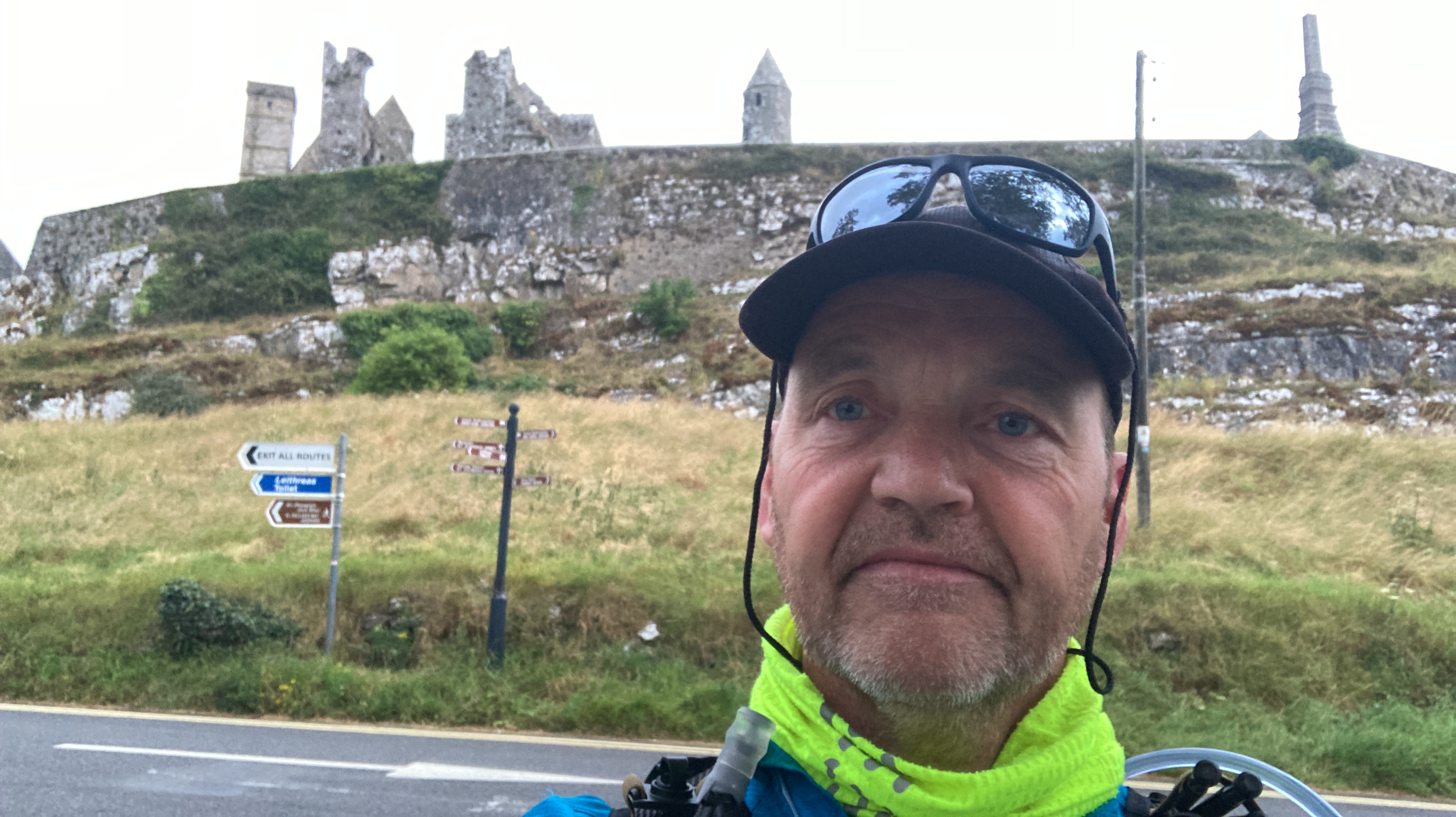
I descended into the kitchen and made myself a little pot of instant porridge. A cup of tea and a banana followed, and some yoghurt. Then I left my keys and slipped out the door. I found my way up to the trailhead without too much fuss. The GPX route loaded into Google Maps was a great idea, and would serve me well. Needless to say, the car park was deserted. Above me rose the ruins of the Rock of Cashel. If you would like to find out a little more about this place, please read the official blurb here. Truth be told, I am long-overdue another visit myself. It’s one of Ireland’s most iconic landmarks, and it was a shame not to be starting the trail somewhere within the confines of the historic ruins.
I waited ’til the clock ticked over to 5.45am, and I pressed the button on the Garmin and set off back the way I came. I had the town to myself. I soon trotted past the doors to my B&B on John Street, and then passed beyond the town boundary. I paused on the top of the hill and looked back at the town with the famous skyline… and realised I hadn’t even remembered to take a snippet of footage of me starting off. This whole business of trying to do a long run and make a short film were poor bedfellows. I had discovered this when doing the GaelForce West Adventure Race last year. (And oddly enough, I had chosen to wear that race top today, as it is well-designed, light, and has long sleeves). Essentially, you can either choose to try and run well and take crap pictures and video, or spend time on the footage, and forget about the run. Oh well. I bid farewell to Cashel and headed south with vague promises to get more clips.
(I’m currently reading Beau Miles’ The Backyard Adventurer, and this quote is like a slap in the back of the head: ‘One guiding credo rules my storytelling now: when you don’t feel like shooting or writing, you need to shoot or write’. In this way, the author has discovered by trial and error, that it is in the mundane and downright odd that we stumble on the quirky truths that lie in our path. I did not record, therefore, many of the interesting and serendipitous conversations I had on my journey, simply because I was having them, and not filming them. Which, in the general scheme of things, is fine, as long as you accept that you are on a journey to experience the journey, and not necessarily trying to make a documentary).
Out across a motorway intersection, and I’m assuming St. Declan did not have to contend with this. But the route quickly settled back into a quiet country lane. I passed a traveller camp and all was still. A few grazing ponies tied up in a field watched my passing, and a pair of ravens suddenly made a racket. No doubt they were surprised to see anyone up this early on their rounds.
A few miles later on, the signs pointed me up a farmyard entrance. I wondered if some local rogue was playing a joke, but a quick GPX check revealed I was on course. Within a few minutes, I jogged right through a farmer’s yard and past their front door. I know some farmers are vehemently opposed to allowing strangers traipse through their land, and have actively blocked progress on greenways for years, but this person was clearly game for having a pilgrim path literally on his or her doorstep. Kudos.
The first milestone was looming up ahead, at the foothills of the Galtee Mountains. I had seen this range over to my right as I left Cashel behind, and wondered if these were the Knockmealdowns, but as I got closer, I realised I would pass these and leave them behind too. Cahir was equally quiet as I arrived with about 22k on the watch. This lovely town, like Cashel, used to be on the main Dublin to Cork road. As a nipper, it was a road we travelled as a family quite often, for holidays in Kinsale. It was a hell of a journey. Forty years ago and more, there were no motorways in Ireland, and the concept of bypassing a town was unheard of. Sure, how else would a weary traveller buy an oul’ sandwich and a cup o’ tea, if you sent the poor divil around the houses? I genuinely don’t know if this next statement is vaguely true, but I suspect there wasn’t an espresso machine in the nation at that time. Mind you, there were a lot of other things missing too, that were far more important, but sure, we have to start somewhere!
I sat down on the edge of a low wall beside Cahir Castle. Somewhere in an old album, there must be a photo of me on this very wall, probably taken by my gran. We always stopped on our Cork journeys because they took so long, and Cahir was a decent halfway point, and the castle was more accessible than the Rock of Cashel. I am, no doubt, wearing flannel short pants and eating an ice cream. I have a bowl haircut of some description, possibly with a self-styled rogue slice out of the fringe as an early sign of dissent, and I definitely have freckles.


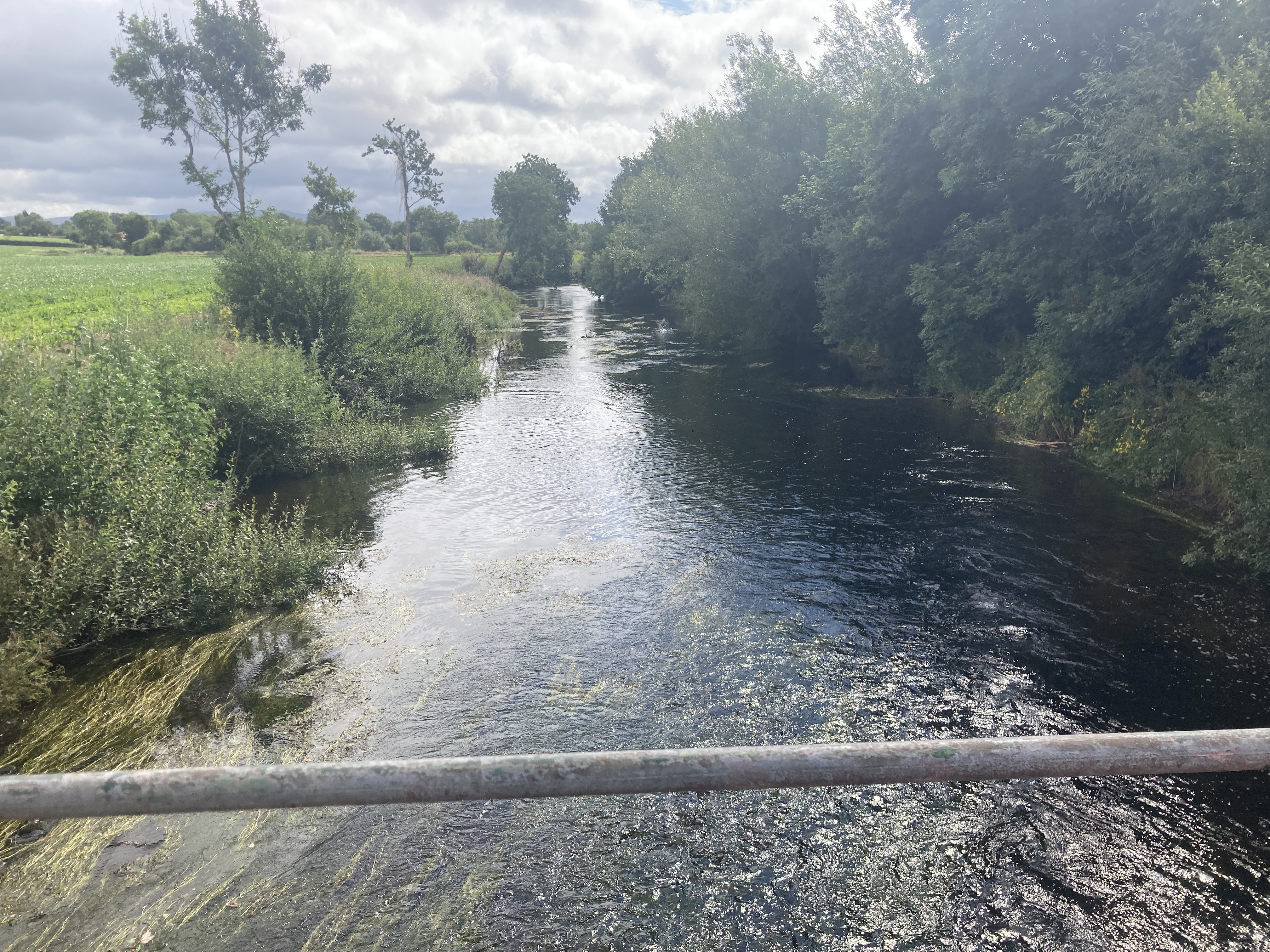
I have bought more water, and eat one of my Clif bars. I don’t want to tarry too long, and there is a moment of confusion when I try and pick up the route once more. I assume I am to head over the bridge, but no; it’s across the car park and through a little gate and onto what looks like a little riverside park. Soon the path takes us onto the river bank proper, and the Suir and I share the journey for a mile or two. Tipperary is starting to wake from its slumber, and now there are some dog walkers and joggers out and about.
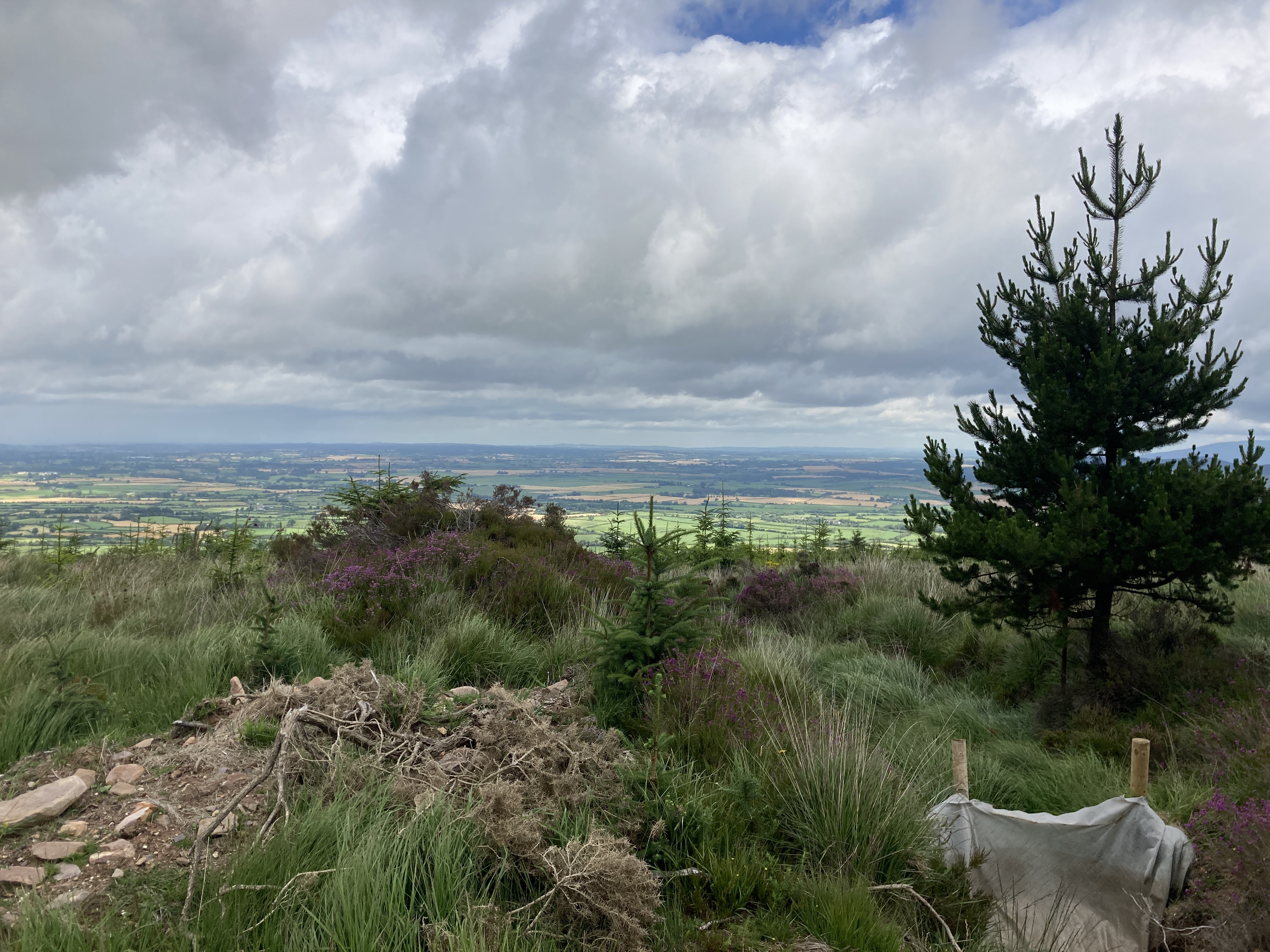
The Suir is one of the three sister rivers: the Barrow, the Nore and the Suir, as we all learned dutifully in school, and it is no surprise that it feels familiar and reminds me of the Barrow Way adventure S and I did a few years back. But the river and I have different paths to follow, and while the Suir takes one look at the Knockmealdowns and turns east towards Waterford and the sea, I have to follow the path, and head south towards the mountains. Once we are clear of the river valley, I get my first proper glimpse of the peaks ahead. The weather so far has been kind. Warm, mostly overcast, a gentle breeze, and an occasional ray of sunshine. But I can see the peaks of the Knockmealdowns are lost in the clouds.
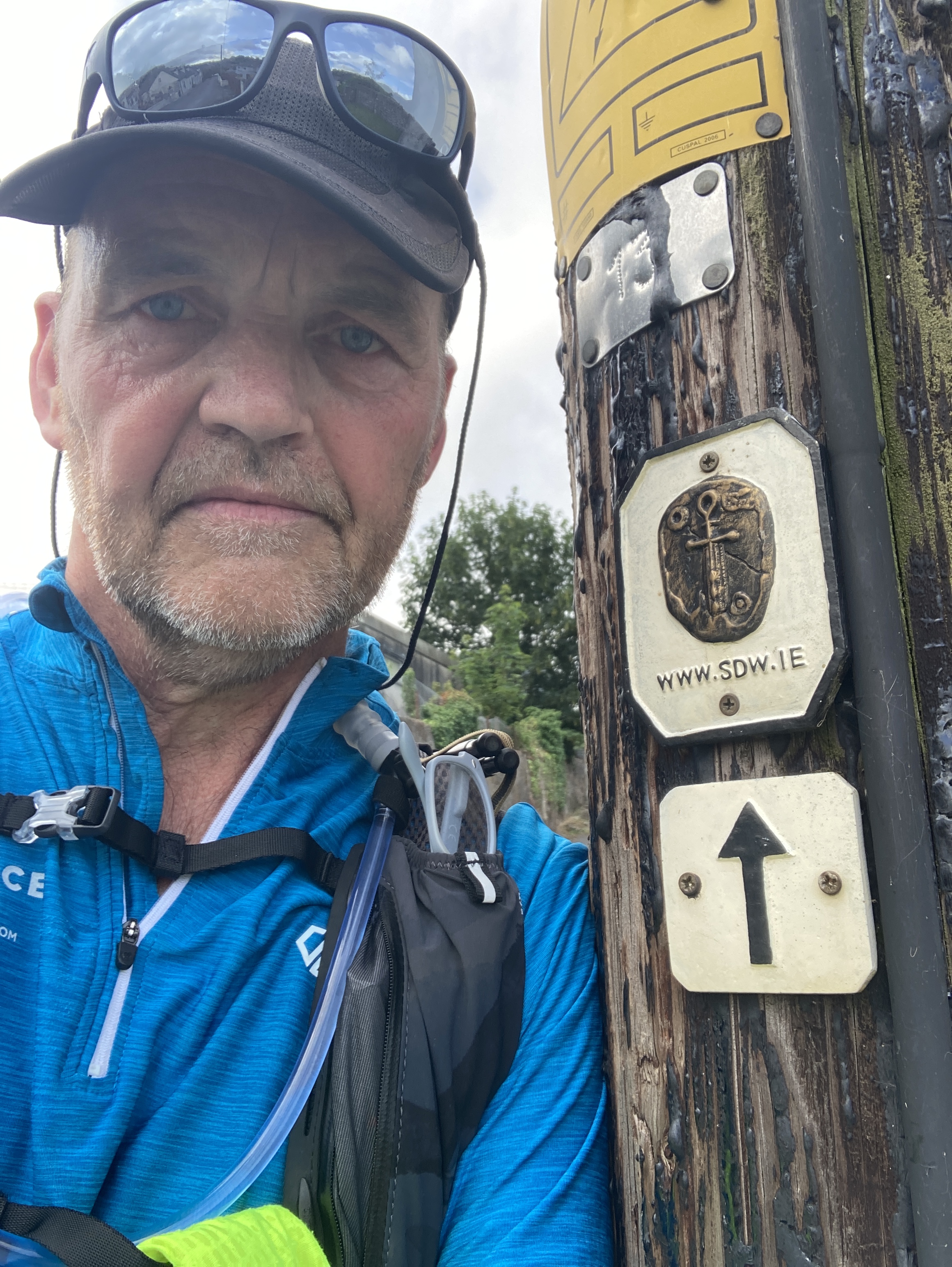
As I negotiate the country roads and keep an eye out for the little blue markers that have been my silent but trusty guide on the Way, I have several déjà vu moments. In my case, this is a literal ‘already seen’ moment, because, as I turn a corner, there is a junction I had randomly sought out on Google Maps Street View a month or two ago when I was curious about the waymarkers. I figured if I could see them online on a virtual drive, then I would not miss them on the run. And so it was turning out, which was a comfort. One thing I suspect most ultra-runners share is the feeling that they don’t mind running a hundred miles as such, as long as you don’t ask them to run a hundred and one by mistake.
When you have one of these déjà vu moments, a brief and elusive connection is made somewhere in your visual cortex. When you are online, looking at a signpost you plan to see in a few months’ time, and then you roll on the clock, and now you are at that signpost, recalling the moment when you were sitting at your desk, looking at the signpost… well, it’s a bit like the first time someone stood in front of a mirror with another behind them, and behold! a feedback loop was created. I have had this feeling before, and when you plan one of these adventures, it does tend to throw up the possibility of a feedback loop more often than not.
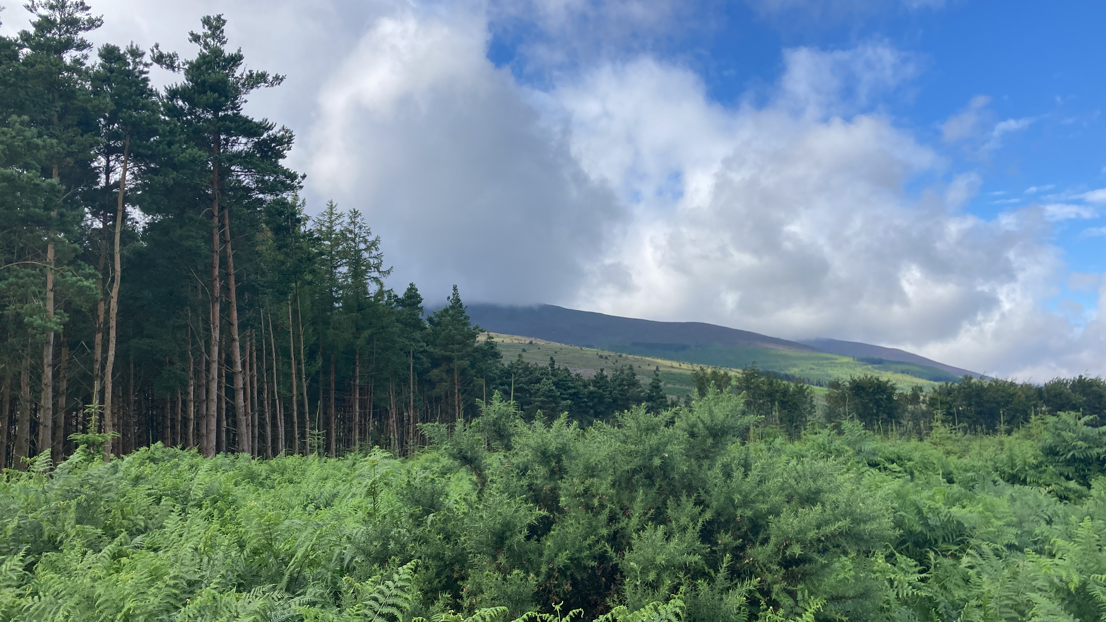
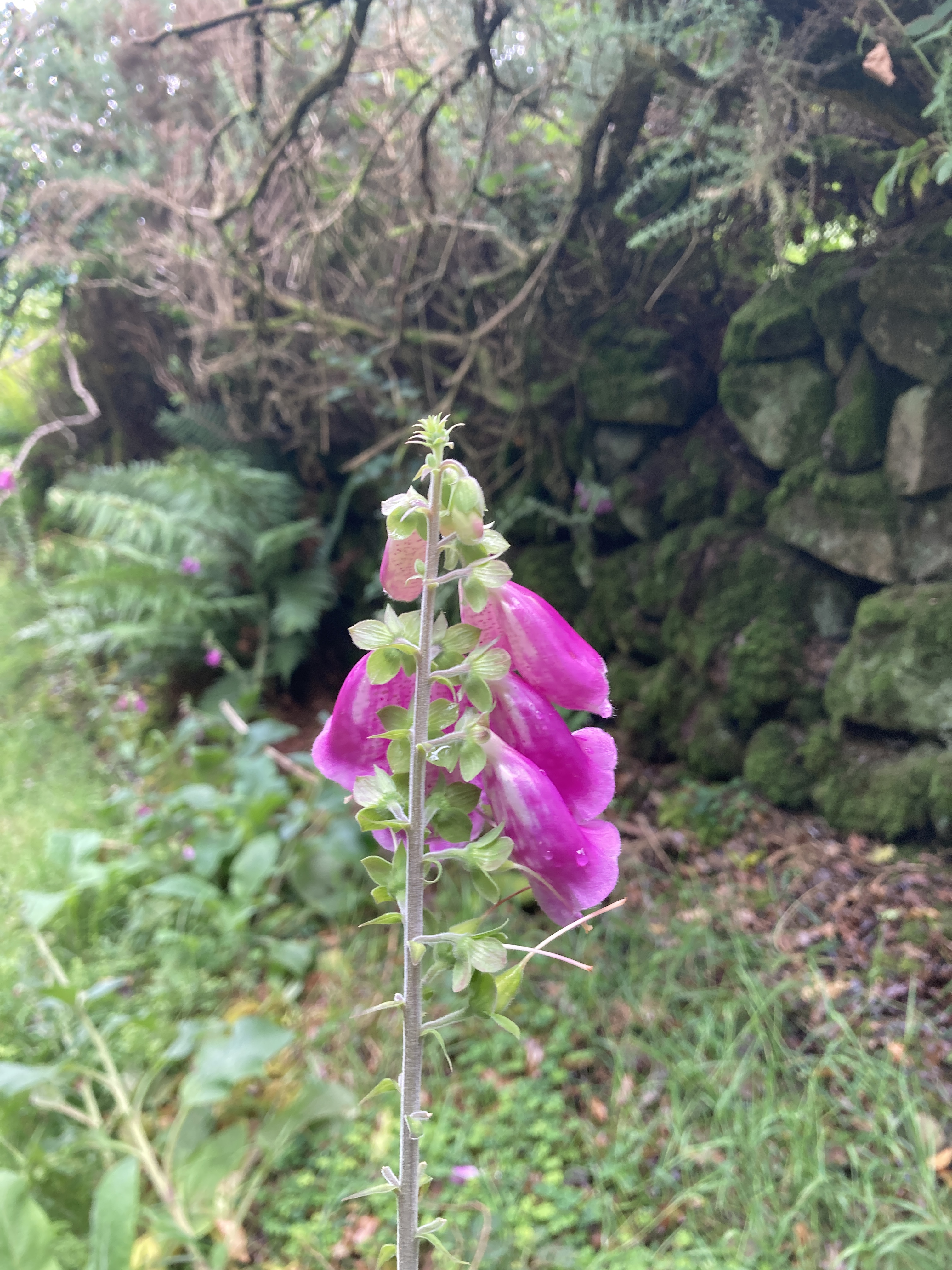
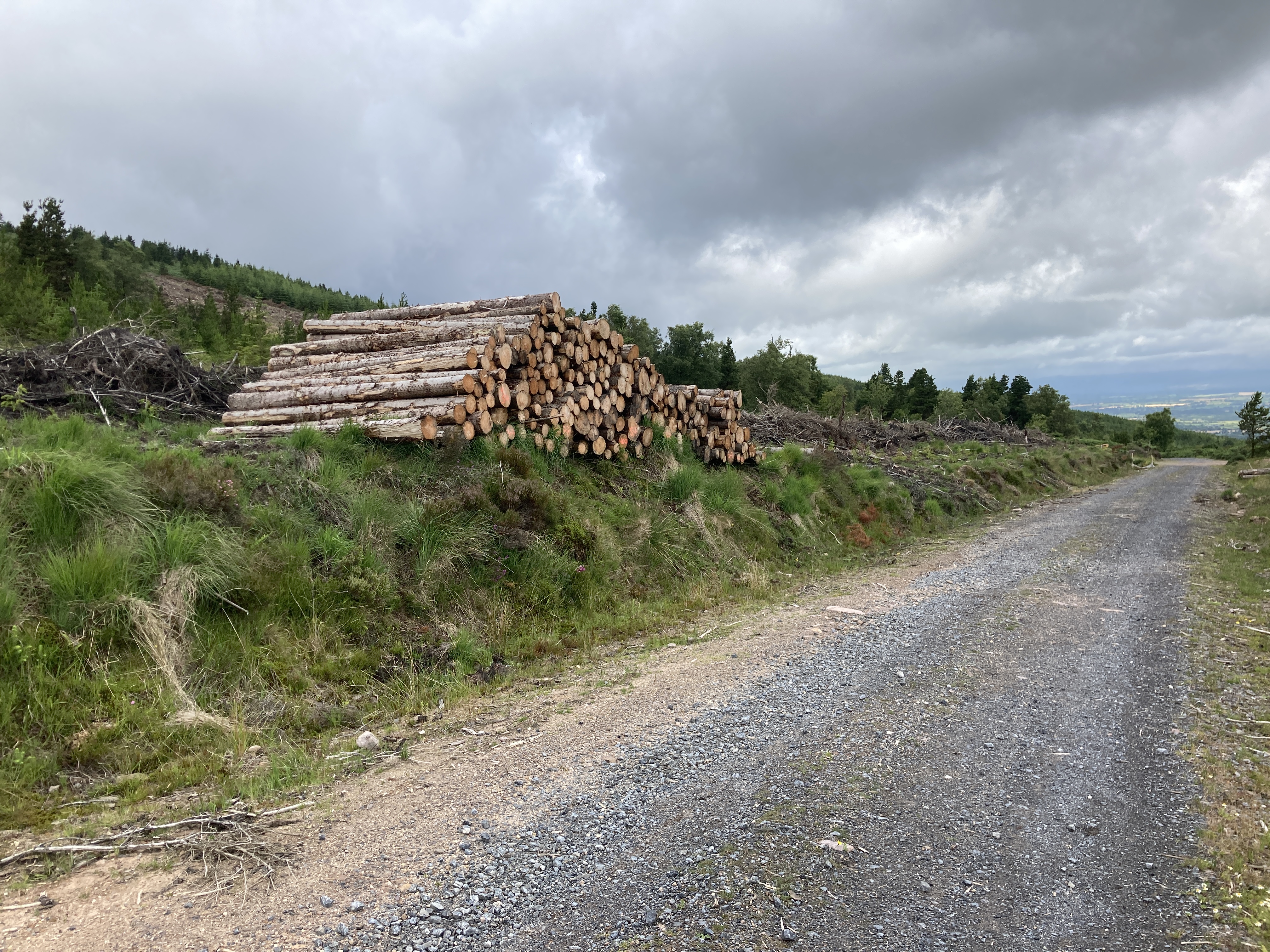
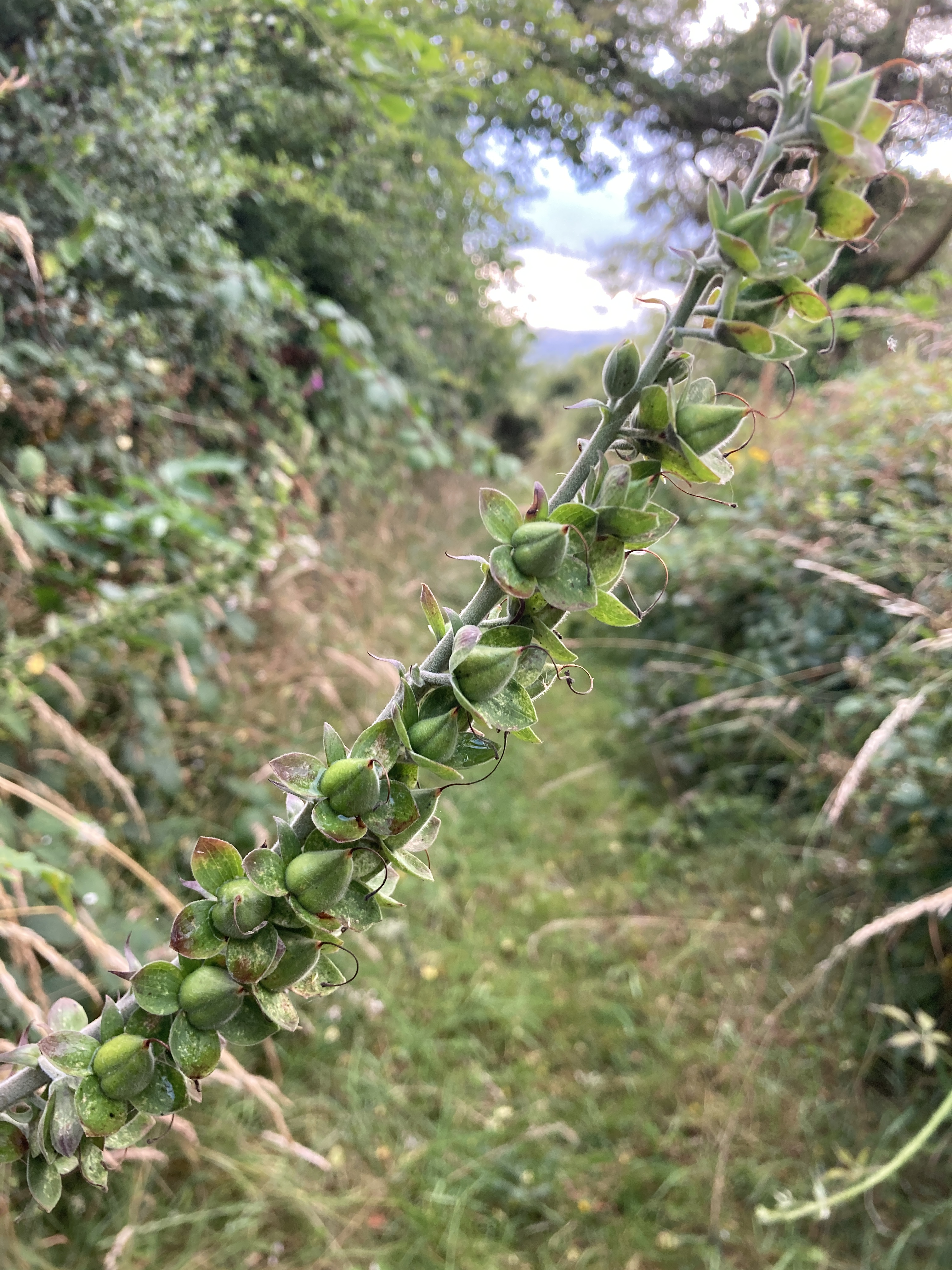
At Ardfinnan, I buy more water in a little shop to top up the bladder pack, and before I start the climb, the watch ticks over the 42k mark after Goatenbridge. I finally leave the roads behind and the Way is now on trails. The sun comes out and I make a brief stop at a bridge over the charming Tar River. I take off my shoes and socks and bathe my feet. I splash water on my face, and soak my cap. Blessed relief. There are waves of warm and muggy air wafting over me, and on the verges, Foxgloves are beginning to explode into life. The moment between the lowland roads and the uplands is short-lived, though, and soon I find myself on Coillte fire roads, and these are rather dreary and unpleasant features of many of Ireland’s uplands. To accommodate large industrial tree-processing vehicles, these access roads take you deep into the planted spruce plantations, and are always made of packed gravel and shale, which, combined with the gradient, mean you are going to be walking, and not running. A few scrambler bikes came my way (illegal, it should be noted), but otherwise I had the mountains to myself for now.


The trail switch-backed and climbed ever higher, and the plains of Tipperary revealed themselves below. I passed the monument to IRA member Liam Lynch, and the trail left the fire roads and became narrow and boggy, before plunging back downhill along a walled, tree-lined stretch, grassy underfoot, that reminded me of our favourite walk in the Burren, the Lough Avalla Loop.

Alas, it was short-lived and I found myself back out on a road again. At least I thought I had traversed the mountains, but I was wrong on this score. I passed three ladies out hiking – the first I had seen on the route. The road began to wind uphill, and soon we would leave the tarmacadam behind and once again go off-road. This time, there was no mercy, and the trail went straight up. I recall somewhere along this stretch, shouting to no-one in particular, that there was ‘no fucking chance Declan came this way’. The weather took a turn, perhaps in response to my profanity, and as the path climbed and the tree cover fell away to nothing but wide open heather and bog, the rain came down. The mac was quickly pulled out and we put our head down and kept climbing. Nothing but sheep for company. Visibility was down to a number of yards. I have no doubt on a clear day, the views from here would be spectacular. Another day, perhaps.
At some point, I passed from Tipperary into Waterford. It was the second highest of the ‘peaks’ to climb in the Knockmealdowns before we hit Glenfalla, the highest, which the watch records at 429 metres. No Everest by any means, but the mountain stretch took about 30k all told, and took more out of me than I had expected.


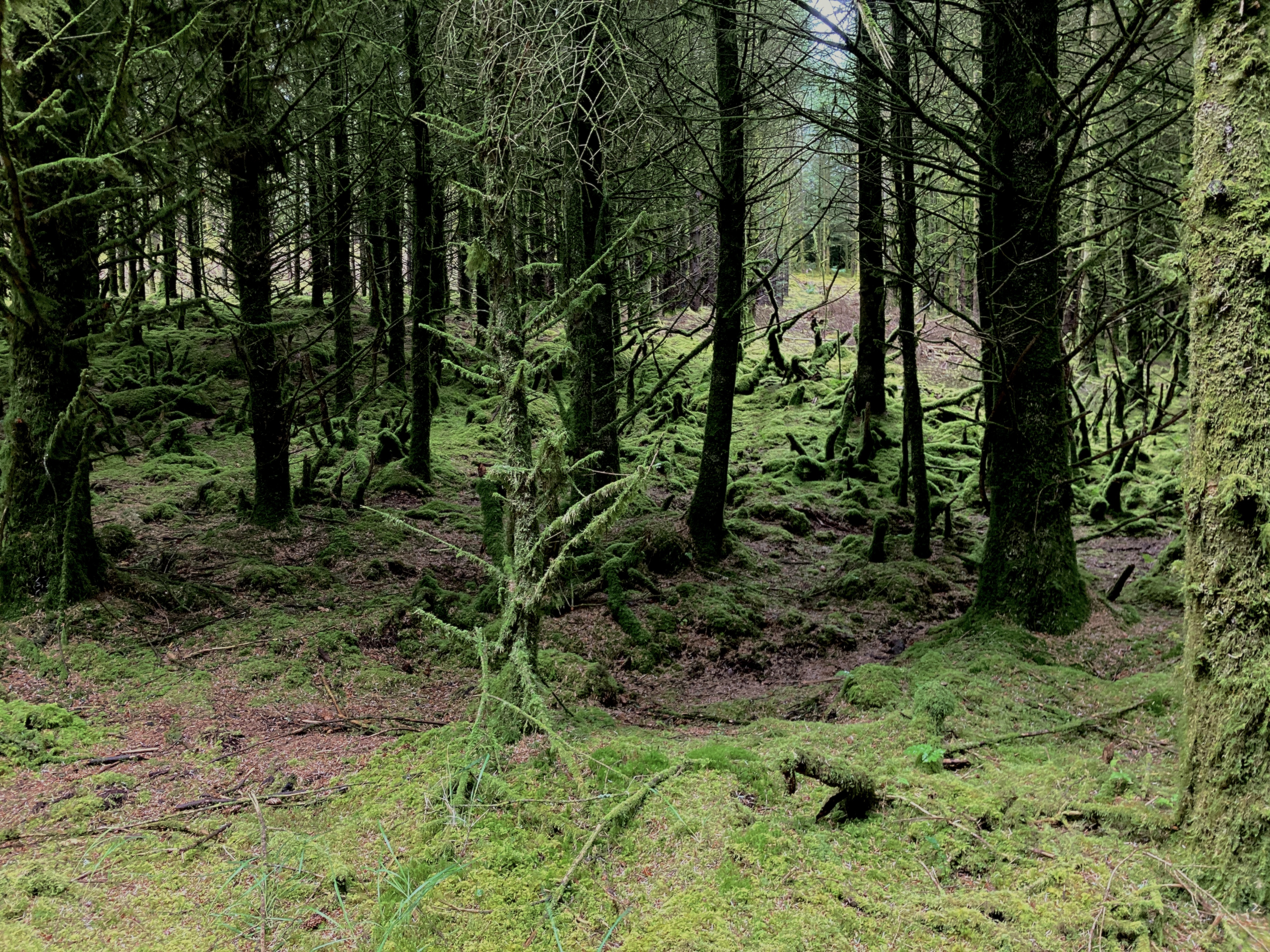
The path dropped back into forestry, and the rain magically cleared up. I had been unintentionally driving a small flock of sheep in front of me, as the path was too narrow for them to ignore me and go around back up the mountain. As I began to think I would arrive at my destination with them in tow, the path took a left into the forest proper, and the sheep made good their escape. The trees here are quite old, and thick with moss and lichen. This is a good thing, as Coillte have a habit of clear-felling swathes of mountainside, creating Dante-esque landscapes, devoid of life, and littered with the savaged stumps of pine. Perhaps some sanity has prevailed here, and the Way will at least have a ‘green belt’ each side of it where possible. With the rain a recent memory, it was time to restow the rain jacket, and reapply some all-important cream to the lower regions; when on a long run, water is both your friend and your enemy. You need lots of it on the inside, but ideally, none on the outside.


As I set off, I heard the chiming of a bell, and it was quite the experience after the adventure over the mountains. I am not a religious person, but it offered some comfort to the weary traveller (not least one who has just been tending to his flock!). It was drifting up the path from Mount Mellary – one of the key points along the pilgrimage.

As I neared the managed paths of the Cistercian Order abbey, I came upon a few visitors who assured me there was a café on the grounds, and sure enough, there it was. It seemed busy enough too. But bad news! No soup! I had had a hankering for some hot soup after the last 30k or so, but they were happy to make me up a sandwich. I sat outside and removed the backpack. The ham and cheese sandwich with a packet of crisps was the ideal lunch, but I could only manage about half of it.
I did neck a pot of tea and a bottle of Coke though, so as long as the fluids were going in (and also coming out too), then there would not be a total collapse of bodily functions. A Chaffinch was bobbing around under the tables, so I fed her some crumbs. A chatty lady was out mopping the recent rain from the outdoor furniture, and we talked for a bit. I mentioned I was on the pilgrim trail, so she assured me – in great detail – that I had to try Medjugorje. I guess all that toil and rain had given me a beatific look. Little did she know she was talking to a lapsed Protestant atheist.
I set off again, and the farm roads gave way to lanes, and then suddenly I was out on a busy road again. I see by the maps that it’s only a regional road, but the dynamics of it are vastly different from any other part of the trail, and I feel like the folks who manage the Way should perhaps install a little more by way of warning signage for the hiker, and perhaps some traffic calming measures for the motorist.
The trail led to some forestry, and we dropped down towards Lismore. I turned a corner into a clearing and there was a small river, and a memory began to surface. Sure enough, I had been here before, many years ago, on a craft course. It was a week-long ‘build-your-own-pole-lathe’ experience in a centre that has sadly since closed. The weather had been fine, and the course instructor had brought the small group to this very spot to see who would brave the cold waters of the Owenashad, whose source was in the mountains I had just crossed. To make the shallow waters a viable option for swimming, the locals took to building a dam each year from pebbles and grit, and along one side there was a concrete pier. It was perfect, really, and the only sad part was that I didn’t have the time to really enjoy it. But I couldn’t entirely let the opportunity pass, so once again I stripped off my shoes and socks and hitched up my shorts and waded in up to the tops of my thighs. If the Tar River was the entrée, this was the main course! Three walkers appeared and we had a chat about the Way, and they were curious about my adventure. I suppose the fact that I was wading around in the river piqued their interest. They seemed genuinely impressed by the whole idea of me doing the Way, though the lady assumed I was on a bike, and one of the gents assumed it must be a race. I assured them it was just little old me, without a bike. They offered to buy me coffee, but at that point, I knew I had overstayed my welcome and I got back on the road again.
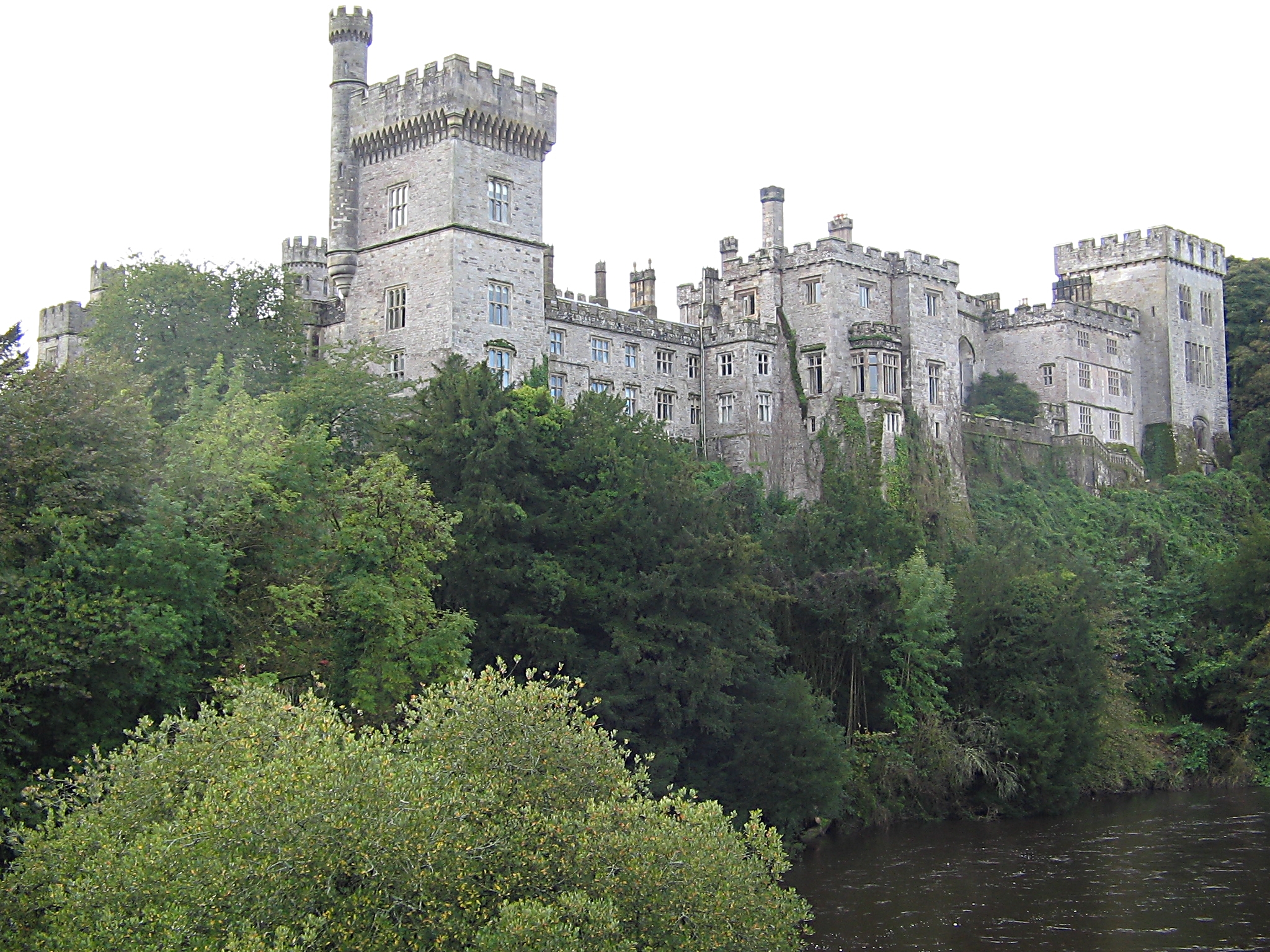
The Way was not going to let me enjoy the charming village of Lismore. As soon as I had crossed the Blackwater and took in the view of the castle as per above, it took a left and led me down the banks of the river. Mind you, this was indeed a pleasant section of the route before I was led out onto roads again, towards Cappoquin. I had eyed up the river a couple of times for a quick dip but nothing presented itself. Just as well, probably.
There was about 75k on the clock now, and the legs were getting very tired. I was running low on water and was beginning to walk for a few minutes before running again. Cappoquin arrived, and I found a shop where I bought more water and large bottle of 7Up. I wandered down the road for a bit, looking for a nice spot to plonk my weary bones but nothing looked promising. I sank the 7Up within a minute or so, and refilled the water bladder. At a junction, I went left, and after about half a kilometre, stopped to get my bearings. I rooted around in the backpack for some meds; I was conscious that not only were the quads really tired and sore, but that the hamstrings were giving out, and the knees were beginning to misbehave. I knew that a knee malfunction at this point would mean walking for the rest of the journey, and whilst that would have been my lot, I was anxious not to give myself that amount of grief and additional time on the roads.
But my mind was playing tricks, or I had forgotten them; either way, I just couldn’t put my hands on them. I checked the GPX and discovered I was off-course. All-told, an additional kilometre, so nothing serious. But when you’re tired and your brain is a little addled, it’s not ideal. Fortunately, the short section back to the Way was downhill, so I didn’t have too long to curse myself under my breath.
The last section, just before I hit about 90k on the watch, started to climb again. In truth, I had not studied the route beforehand in any great detail. And certainly the overview I did have did not include an elevation map. It’s possible there isn’t one. This you can look on as an amatuer error. Personally, on all these adventures, I firmly believe you need to leave some things to chance and mystery, otherwise what’s the point? I was not flying to the moon; I was simply moving under my own steam from point A to point B, which is something millions of people do each day on this planet of ours. I had enough food and drink for the journey, and if disaster befell me, I only had to whip out my phone, and any number of good friends would have come to my aid, albeit a couple of hours, obviously!
The official website suggests this last leg is ‘Aglish to Ardmore – 20km – flat terrain on back roads, tracks & finishing along beach.’ I may have to have words! There is a climb of nearly 230 metres which may seem like small beer in the general scheme of things, but when you are starting from pretty much sea level, on tired legs, it’s substantial. But the real problem was the terrain. The Way here took in some very narrow little pathways that were quite overgrown and rocky underfoot. In one section, it was so thick with brambles and nettles, I had to skirt around it into a field. Had there been cattle in the field, we may have had a more serious problem. I picked up a couple of bloody scratches on my arms as I tried to make time. Mostly, running was impossible unless you fancied a tumble and probable injury.
The path dropped back down again eventually, leaving the hill and wind farm behind, but the trails did not improve much until we finally found some road again. The roads were ‘lumpy’, to borrow a phrase from a cycling buddy. There was plenty of walking between the running, and now the race was really only against the clock. The evening sun was lost behind a low bank of cloud and for the first time on my journey, I was aware of the fading light.
Some time before the 100k mark, I heard a gull. A common enough sound, even around my inland hometown, but this was the first indication that I was getting close to the sea. As the watch ticked over to read 100 kilometres, I rang the hotel to let them know I was still on the road, making progress. My progress had slowed now that I was run-walking, but I estimated about 11.30pm. I sat down in a gateway to fish out the head torch from one of the many zipped pockets, and the little bottle of meds tumbled out. Aha! I took an anti-inflammatory anyway.
The last leg into Ardmore was very much an up and down experience, both in elevation and in mood. I was back running, mostly. I had met a fine, cheerful black lab called Toby and that had given me a lift. In fairness, you will never meet an unhappy Labrador. The owner warned me that her hound would follow me anywhere, but I suspected even the faithful Toby may not have fancied Declan’s Way in its entirety.
The final headland was rounded and there ahead lay the lights of Ardmore. I cautioned myself about the siren song of lights in the distance, not least since my experience with Roundstone during the latter stages of the Connemara 100. But these seemed to get closer in more or less the fashion I expected them too, and soon I was running through the car park near the mobile holiday homes on the beach, and the rutted, sandy track by the top of the beach itself.

I could hear a gang of roudy teenagers up ahead in the centre of the village, but I generally find the noisy groups are the least trouble. I stopped amongst them and asked if they knew the final loop of Declan’s Way. One young girl did know the path, and pointed me in the right direction. Before I set off, I rang the hotel again, and spoke to the hotelier who I had dealt with earlier. It was about 11.30pm.
Once I explained that I was in Ardmore, he sounded somewhat relieved, and suggested he’d throw on a pint for me as promised, as I was literally a hundred yards from the hotel, then he was rather dismayed when I said I needed to do one more final loop around the back. Around the cliff path, he exclaimed? At this hour? Madness! No, really, you can’t be doing that now. Sure I’m sitting here with the head of the local coastguard station, and he’s shaking his head too. At best, you’ll sprain your ankle, and at worst, you’ll fall off the cliffs. Either way, we’ll be out all night looking for you…
And thus ended the journey. I knew my goose was cooked. Had I not rang, I would indeed have set off around the top path, but I may not have made it. Had I slowly felt my way around the path, it would have added at least another hour, for that is what he said it would take, and that was during daylight. So possibly longer.
Moot point. I was in Ardmore, and my journey was over. Nothing for it but to retire to the bar of the hotel and sink a pint of Beamish before I myself sank beneath the waves of tiredness. I met a few locals in there, and they were all very kind, and indeed, seemed impressed with the journey. There were a couple of runners, too, and they agreed that the last leg was rather hilly.

But now that the Garmin had officially stopped, another watch was ticking. This one was measuring in minutes the time I had left before everything started to shut down. The brain does, of course, stay switched on. Not in any useful way, of course; more like some drug-fuelled hallucination, but the body was shutting down, piece by piece, so I drag myself up to my room, and as I lie in bed after I have showered like an arthritic octogenarian, the brain is still out there somewhere, somewhere along the Way…
The following morning, I arise before the alarm once more and I shower again. Clean clothes feel like a mystery and a luxury all rolled into one. The only downside is that I forgot to pack extra shoes, but for some bizarre reason, I had copped this the night before and left the Hoka runners out on the window ledge to dry out as best they could.
A full Irish breakfast is managed, carefully. I still marvel at the tiny shot glasses hotels provide for the orange juice, and indeed, the finely ground pepper seems to be unique to these places too. But the Round Tower Hotel is spotless and well-run, and the manager there is a decent soul, and I would recommend it to anyone if you are in those parts. He was not around to thank again, so I left a quick note of thanks for his kind hospitality and drove up to have a quick look at the cliff path. It did indeed look a little gnarly, and would have added another 4k onto the journey. So whilst I did run from Cashel to Ardmore, I did not officially finish Declan’s Way, and will therefore not be able to submit my effort to the FKT committee for consideration.

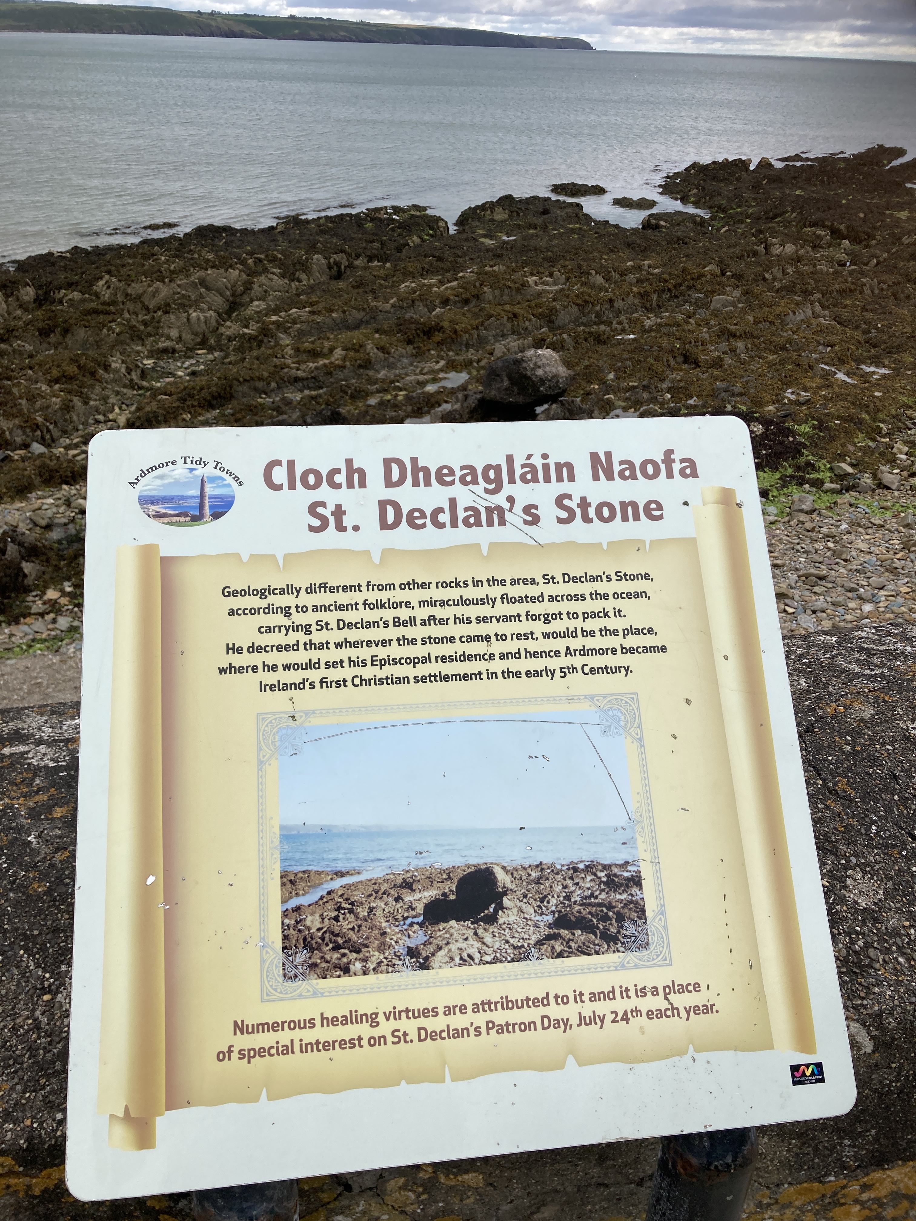
I drove back down to the beach and took a wander along the seafront. Three elderly gents were taking in the air and I asked them was there an actual Declan’s Stone, as in the myth. Oh indeed there is, they proclaimed, and pointed me in the right direction. Down on the rocky shoreline, just above the tide mark, sat a large erratic boulder. Erratics are typically glacial in origin. The story of Declan’s Stone can be found here. It’s interesting to speculate that it may have been a burial site; it seems unlikely, due to the surroundings, despite the differences in sea levels. But I suspect it will remain a mystery.
I recorded a few thoughts on video and then got on the road one last time. The journey back to Leixlip was as equally uneventful as the trip down, and soon I was back at home.

So, what’s it all about? In describing beforehand to anyone interested in the Way attempt what it was in running terms, I would say ‘it’s a 5k warm-up, followed by a marathon, then a half-marathon, then another marathon, and then a 5k warm-down.’ And I hadn’t even included the 1,500 metres of climbing. The general response was: ‘that’s nuts’. Or something. I am used to this, and expect it.
One of the reasons to do these things is simply to test one’s physical and mental resolve. Declan’s Way is not by any stretch a difficult challenge. Had I the wit to take it on board at the height of Summer and set off earlier, I would have had the light to finish it properly. But that’s a minor detail. Overall, I’m pleased with the day’s work.
When you are out like this for the day, a day becomes a very long thing. And that has meaning in itself. I think the modern world, by design, insulates us from the reality of a day. It may tell us to the second what time it is at any given moment, but that is often meaningless, and is usually a sign that you are bored in work, and are clock-watching. When you are out on a trail for the day, the time is not especially critical unless you have a destination to reach before a certain cut-off. What is more relevant to you is the weather. Is there rain up ahead? Will I miss that heavy shower? Is it warm enough to take off this jacket? And where might be a decent place for a pitstop? And is there soup?
And of course, an hour can stretch for an eternity.
Decisions become both mundane and wonderfully delicious. A bottle of pop never tastes so good when you are parched and are fifty miles into a run. A day stretches out, seemingly forever, not least when you are trying to run through most of it. There are days when you literally sit on your hole and do fuck all, and get frustrated, knowing there are a million and one things to do, and you have done exactly none of them.
When out running, you really only have one thing to do, and that is to keep moving forwards. Cynics sometimes trot out the line to me that ultra-runners are all running away from something. I don’t believe that, any more than we are all running from something in some fashion. Nor are we necessarily running towards something.
We are simply running.
And sometimes that’s all it needs to be.


Fun(ish) facts:
- The Garmin watch stayed up for the whole journey, so that is impressive. I had turned off extraneous features to preserve battery life, and that seemed to do the trick.
- Likewise, with a couple of brief charges, the phone had plenty of juice too.
- Neither the GoPro battery or card needed changing, but this is not actually a positive as such. Rather it points to me not taking enough footage.
- The sunglasses perched on my head in various selfies never actually made it onto my face. Not sure why I bothered really. I think they were protection from a possible midge storm on the mountains, but that never materialised.
- The GPX route onto the iPhone on Google Maps was ideal.
- The waymarking was excellent, even if some of the paths were hard work and in need of some serious attention.
- I dropped down to 75.5kg (or probably less, in fairness). I have spent the last few days trying to put it all back on again…
- I genuinely thought there would be lots of folk out on the Way, especially given the day. But I really had the place to myself, and even the roads were remarkably quiet.
- It’s great having wonderful friends like Mark.
- My family appear to still love me, despite my crazy peregrinations.
I can’t finish without paying huge credit to the ‘Way committee. To the outsider, these projects may not seem like a lot of work, but having been involved in a local heritage walk of a very modest 16k, I can assure you there is a huge amount of work involved. Make that 115k with who knows how many local landowners (well, I guess the committe know!) and a county boundary… well, believe me; it’s a massive project.
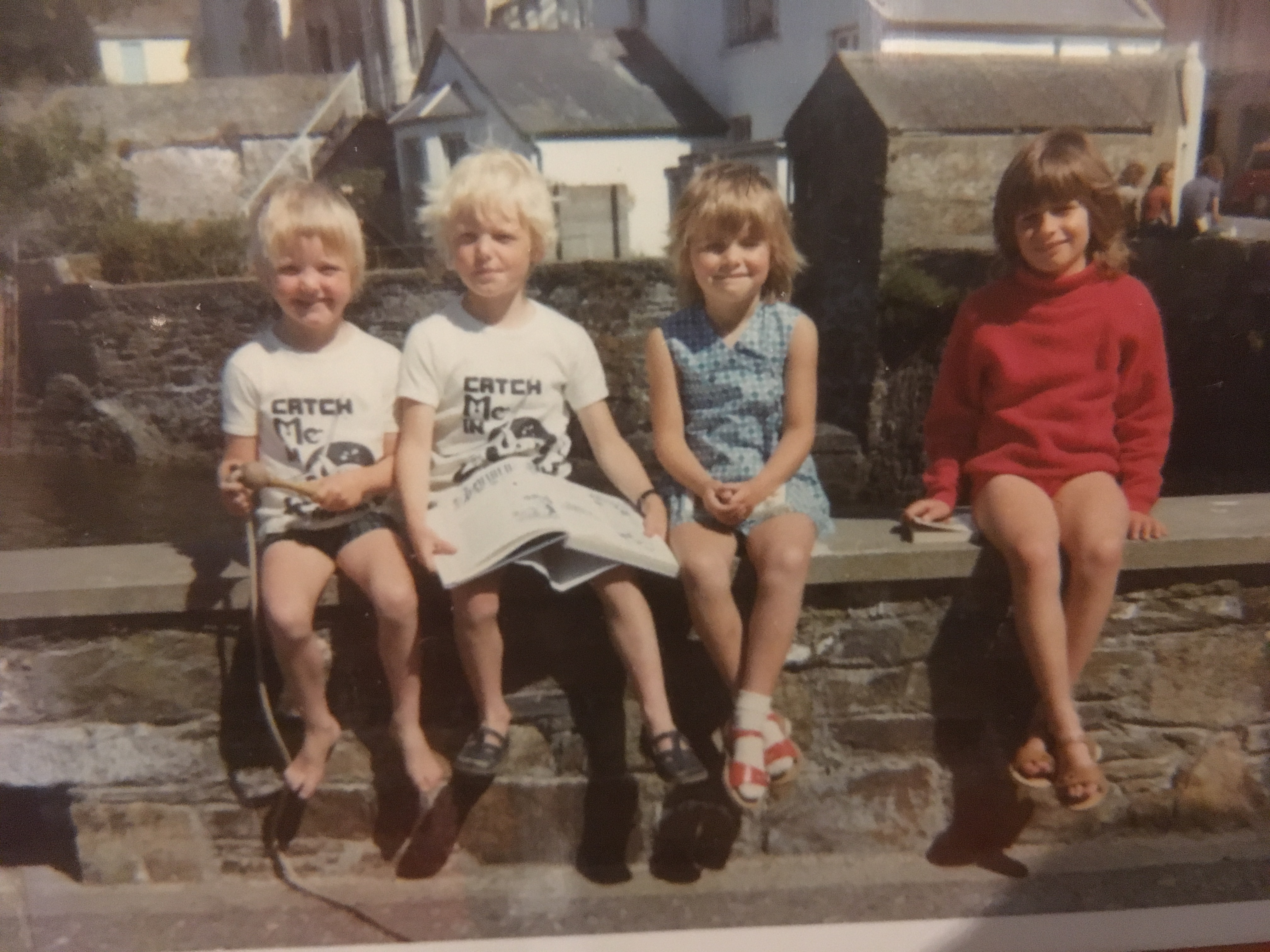
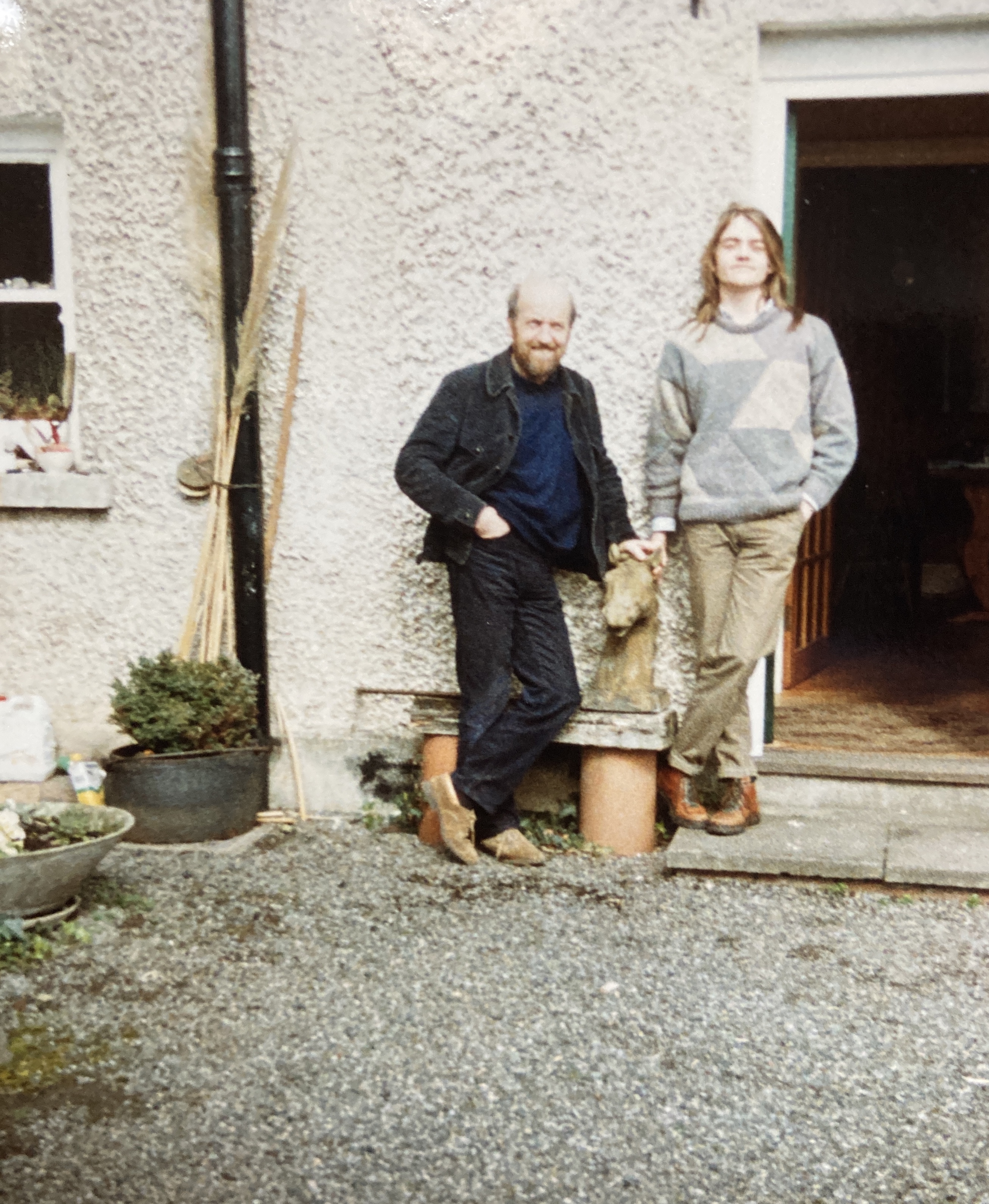
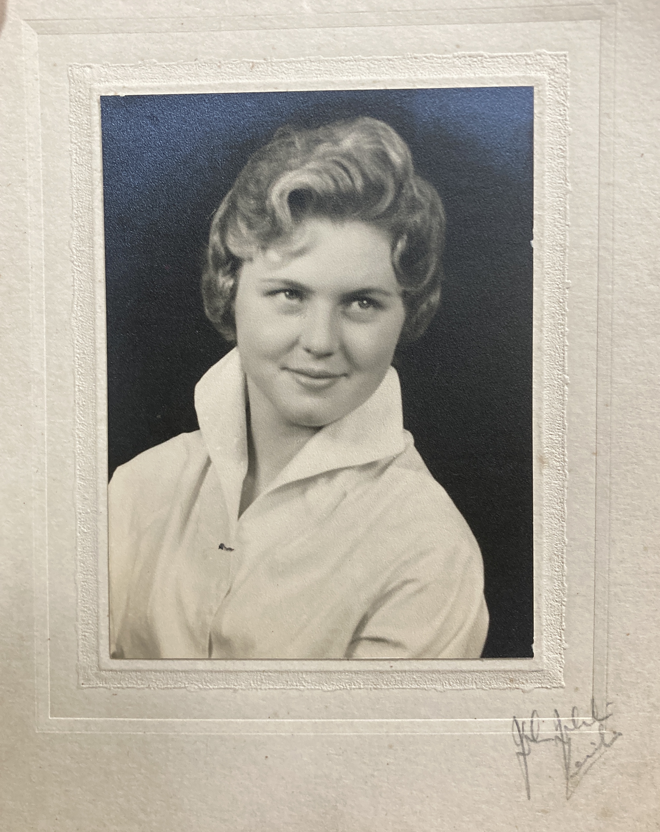
And finally, I know it’s tradition to finish with greyhounds, but look; they did bugger all for this blog, so instead I will post some old pics. Once I had an idea that there might be a photo of me in Cahir with my gran, I went looking for one in some old albums, much to my Mum’s bemusement. I haven’t done a thorough search but I did unearth some gems, so in the absence of a freckled child eating a 99 at Cahir Castle, I will instead post these in honour of my parents.


Jaysis I’ve been waiting for this for a week! Time to put the kettle on! Have you considered doing an audible version?
LikeLiked by 1 person
There’ll be a short film, of course 😎
LikeLiked by 1 person
A great read. Hopefully get to catch up with you in person soon. I look forward to the film!
LikeLiked by 1 person
Magnificent, congratulations. I enjoyed reading the account so much that I think I don’t need to do the run myself. Thank you.
LikeLiked by 1 person
We aim to please!
LikeLike
Cahir Castle is beautiful and I’m glad you didn’t do the loop in the dark. 😉
LikeLiked by 1 person
Cheers Jim.
LikeLiked by 1 person
👏👏👏👏👏👏👏
Brilliant achievement and a very well written account. It’s taken me a few goes to get through it all, must have taken nearly as long to write about as to run!
No matter what I say I can’t express my full admiration for what you’ve done so I’ll settle for a simple well done and a 🤝
LikeLiked by 1 person
Cheers Niall. Much appreciated. Rest assured it was quicker to write. And easier. 😎
LikeLike
Oh yeah, definitely easier 😊
LikeLiked by 1 person
Wow, brilliant read and great achievement!! Well done!
LikeLiked by 1 person
Cheers. 👍
LikeLike
Well done and thanks for sharing!
LikeLike
WordPress hates me. I’ve tried to leave a comment 3x in the last 3 days … 4th time’s the charm?
Hands down, this is the richest “run”-down of a run yet to grace your blog (since I’ve been following, anyway). My comment would need to be half as long as the post to cover all the ground I’d like to (wink emoji), but I’ve gotta say it was grand being with you every step of the way, I’m torn between relief (you’re alive!) and dismay (no official recognition!) that you didn’t do that last jog around the cliff, and that pic of long-hair you and your handsome da is primo.
LikeLiked by 1 person
Sorry to hear WordPress is acting up but yep, this has appeared in perfect working order. Thanks as always for your kind words. The committee have been in touch since, and did confirm that the last loop isn’t officially part of the Way, so that will do for me. On to the next challenge 🥳
LikeLike
Well done Declan! I saw you on facebook somewhere as well. I didn’t realise you were doing the Way by yourself – hats off. What an experience and a lovely write up. What was that about not officially finishing it and not being eligible for something?
LikeLiked by 1 person
Cheers Julie. There is an official route and I had registered it as a Fastest Known Time option. Bit of run really. Google the site. It’s a thing in the ultra community. My ‘time’ would have been laughably slow in real terms. But the plan was to be the first 😉
LikeLiked by 1 person
How many hours were you on the go in total? How long did it take to recover?
LikeLiked by 1 person
All told, just shy of 18 hours, which includes about 90 minutes of stoppages for loo breaks, buying drinks, eating lunch, taking photos, etc.
LikeLiked by 1 person
As for recovery, I was up and down scaffolding all day on Tuesday and Wednesday (the run was on Sunday), so that helped soften the quads up! Had a 10k run the following Sunday, but I can still feel all those miles in the legs, so it will probably take another few weeks before I am back to ‘normal’.
LikeLiked by 1 person
Ah yeah, you will need a good rest after that! It’s a fantastic achievement, and your photos were lovely too. You always take a good one!
LikeLiked by 1 person
Cheers!
LikeLike