We’re about 5k south of Carlow, and there is a diversion off the Barrow Way for essential maintenance. At first, being Irish, you assume the plastic barriers, warning tape and signs couldn’t possibly mean you. But as you begrudgingly leave the towpath that has become something of a lifeline over the previous day, you spy a digger up ahead, and see that the bank has suffered some sort of collapse and is indeed in need of repair. S is delighted. A smooth piece of road for at least 3km. No bumping, rattling and shaking. Brief respite.
It feels odd to be out on the road after the relative tranquility of the river and canal banks. It’s Wednesday, May 23rd, 2018, and the sun is up and the heat is on. I’m sweating profusely. Somewhere off to the left, hidden by trees, the Barrow River snakes along, minding its own business. S is up ahead on the bike. My plan, with the luminous yellow running top, is to afford some warning and protection from the traffic, but she is clearly enjoying the freedom of not following behind me and has thrown off the shackles and vanished on ahead. So much for my idea.
For the first time, there are dips and hill on this journey, and it feels odd. As I pass the hedges on the left, there is a strong smell from the fields; someone has been spreading slurry. The damp heat rises off the road in waves and all of a sudden I am no longer in Carlow but transported back to Kibworth as a child where I grew up, in the heart of England. It’s Summer, and it’s hot, and I am near a red-bricked railway bridge. There is a memory of creosote but in fairness, somewhere in my amygdala and hippocampus, it’s fighting with the smell from the cattle, and the bovine odour is winning. ..
It’s a detour in both a physical and metaphysical sense. The actual detour takes about 3k; the brief time travel to another life is much shorter, and soon we are back on the Barrow, and back where we want to be.
But this is not the start of the journey. So perhaps we should wind the clock back a bit…

I’m not sure where the idea of running the Barrow Way came from. My good friend calls these ideas ‘brain farts’. The ones that bubble up and pop like gas from a swamp. Mostly they need to be allowed to disperse and not linger. But occasionally, they do, and they seem to get a hold on you. And before you know it, they have semi-corporeal form, and take up residence in your head. You can only give them their marching orders once the task has been carried out.
There is the annual Stone Mad Ultra run, and that does a chunk of the Barrow Way (about 64k), but not all of it. Perhaps about half. I seem to have a problem in that regard. I would like to do the Camino one day, but I know I could not do a part of it. I would have to do it all. All 800k of it, and then still walk out to the coast at Finisterre… I’m not sure what this state of mind is called, but I’ve heard it referred to as pigheadedness before.
And the other reason I wanted to see the Barrow Way in all its glory is that there are plans afoot to turn it into a greenway. Now the phrase greenway is something of a misnomer in this instance, but to read more about it, I suggest you visit this site, which tells you all you need to know. S and I have enjoyed two of Ireland’s best-known greenways. Westport to Achill, and the Waterford Greenway are both superb. The main reason for this is that they both follow old railway lines that have been converted into cycle paths. You can of course walk them, but the main mode of transport is the bike, so needless to say, local businesses spring up to cater for this; bike shops, obviously, but also cafés, restaurants, B&Bs and hotels all benefit. Where the Barrow Line differs is in its very fabric.
To understand the Barrow Way, you need to understand Ireland’s built heritage from the Industrial Age. This page here gives you some great insights into the troubled and at times expensive history of the massive undertaking to turn a river into a navigable waterway for large boat traffic. In the mid-1700s, canals were seen as the best way to move large loads around the country. Barges were the articulated lorries of their day, transporting all manner of bulky goods from grain to coal, to quarried stone. There were even passenger boats. In order to make the river navigable, every set of rapids needed to be bypassed, and to do this required a long section of canal and a set of locks to drop you back to the river.

What all this potted history means is that the towpath of both the Grand Canal Barrow Line and River Barrow were fashioned for barge traffic. All built by hand, the towpath was naturally a grass track, suitable for horse-drawn barges (this equine power was superseded by diesel engine). The canal towpath sections tend to be quite narrow in places, but along the Barrow, they are wide, and the grass is kept mown. In essence, this has created a pathway that naturally suits walkers, joggers, anglers and cyclists. It deters the speedier cyclist, as the ground can be a little patchy in places, but it is what you might call democratic in that sense; there is something for everyone to enjoy, and the terrain underfoot is a great leveler. The plan currently is to dig this up and replace it with hardcore and blinding. Essentially, try and create what would be one of the longest ‘greenways’ in the country. The jury is out. I suspect (as is the way with most things in this country) that money will in the end speak louder than the environment, and the local authorities, and Waterways Ireland, will have their way. No doubt there will be some benefits to the local economy and you cannot deny that these towns and villages need all the help they can get.
For now, it remains green. Maybe one day we’ll return, and it will be all changed.
The first stretch of the Barrow Way is along the Barrow Line of the Grand Canal. This is the ‘missing piece’ of the puzzle that links the Barrow River – Ireland’s second-longest – to the network of canals that join Dublin to the Shannon. If you start in Robertstown in Co. Kildare, the journey is about 120k in all, though this mileage varies depending on what book or website you refer to; possibly the discrepancy is also down to where you start and finish.
Anyway. Partly inspired by the Stone Mad Ultra, possibly a desire to see the Barrow Way before it changes forever, and finally just because it’s there, I hatched a plan to run the Barrow Way over two days, with S riding shotgun on the bike. As with all ‘big picture’ plans, it does all seem rather straightforward from a distance. But with 120k stretching ahead of you, there is ample time for you to question this decision. And question it we did.
From a logistics point of view, the first trick was to get transport back home sorted out. Ciaran from the brigade turned up trumps. We drove down in convoy to St. Mullins and left my car at the B&B and returned home in his car. Mind you, I should have taken warning from this relatively easy part of the adventure, as I managed to get us lost about four times on the way down, which was a portent for the following day. Not only that, but it sure felt like a hell of a long journey. By car…
Ciaran’s generosity extended to the next day. We were up about 6.30am, and after a quick breakfast, threw the bike into the back of the jeep and set off for Robertstown about forty minutes away. The bike was unloaded, the watch was set, a quick pic or two was snapped, and then we were on our way.


We had no specific plan for pace or time, other than we would do it in sections and allow the various settlements along the way dictate stop-overs. That, or the need to pee, or take on some water, or just stop and take a photo. We had over 65k to do, though I should say at this point that I really don’t know what sort of distances we covered. My Garmin watch dies both days. Our companion guide on the trip was the rather excellent pocket book from Lenny Antonelli.
In this book the author details not just the Barrow Way but many other great walking routes in the East (our own St. Catherine’s Park even gets a mention). But as I tot up the author’s distances for each section of the Barrow Way, it doesn’t quite add up to the total distance. And if I look at the first recording on the Garmin (from Roberstown to Monasterevin), I see that the figures are a bit screwy. It seems to have recorded the total distance to when the watch died, but only mapped the first 25k or so. The upshot of this is that my stats are pretty useless. But no matter.


But the watch was the least of our problems. Failure to read the book correctly (my fault) meant that we crossed over a bridge when we should have stayed where we were. As we soldiered on, the towpath vanished and we were forced onto a rough dirt road which petered out after a short distance. We struggled back onto the canal towpath which was at this point heavily overgrown. We couldn’t see the opposite path to make out if it was any better, but in any case, the far bank was another world. There was no way to reach it without a bridge, and there was no bridge in sight.
The going was tough. The bike had to be wheeled, pushed and cajoled. Soon, the towpath reappeared in a more civilised fashion, though not before I had electrocuted myself on a fence. Payback for poor map-reading. But worse was yet to come.
As we approached Rathangan, we gave a sigh of relief. Now we could find our way back to the right side of the canal, and be about our way. But in a Kafka-esque twist, the track led us up the garden path (to mangle a metaphor). We were in the back end of a disused and abandoned warehouse; all overgrown concrete, broken glass, graffiti and barbed wire. Through the high wire fence and padlocked gates we could see the humdrum life of Rathangan town pass by. We were fingertips away from it. The more we studied the options, the more depressing it seemed. The last bridge was miles back and neither of us wished to retrace our steps. Whilst we could have scaled the gates, the heavy bike was going to be a massive problem.
Then S spotted two hi-viz-clad council workers in a van, and started waving at them. After a brief explanation of our problem, they kindly helped us get the bike up and over the gates, and within minutes, the nightmare had passed. I gave myself a good arse-kicking (well, in a mental sense, rather than a literal one) and we continued on our way to Monasterevin. It did upset the mood for a while, and at this juncture, I should point out that this was S’s birthday. This was not, of course, any great surprise to either of us, and we had done present-opening before breakfast that morning. We hadn’t contrived to overlap birthdays with ultra-run/cycles; it just sort of happened that way.
We made our way into Monasterevin, and god bless ya, but there’s fuck all in that town. I know this as there is a fire station there, and I have done a few cover sessions when crew numbers are down. I mean, don’t get me wrong, good folk of that town, but there’s not even a newsagent to buy a bottle of water. And it’s a decent-sized town as well. Clearly one that has seen more prosperous times. Certainly, all the evidence of a settlement that thrived when the barges were plying their trade. But now, it was exhibiting something that would become a familiar sight along the Barrow Way: massive, sturdy but otherwise derelict mills that tower over the landscape. A sort of architectural equivalent of Ozymandias. Albeit set in a landscape where the lone and level sands give way to bogland…
We nearly set off on the wrong side of the canal again, but this time we were more careful to check the book. By this stage, we had over a half-marathon done. In terms of physical effort, it was easy enough. In mental terms, it had tested us a little more than expected.

Vicarstown was our next stop, and alas I had let my mind wander. Noting that there was an inn on the map, I had conjured up the coolest, most delicious glass of ice-chilled Coke that no marketing guru has yet to realise in print or film. A small huddle of barges nestled along the jetty, and a young lady greeted us, paintbrush in hand, doing some renovations. The inn? Oh no. That doesn’t open ’til four. Four? That was an eternity away. The vision slipped from my mind, and I felt a little of my mind slip with it.
But help was at hand in the form of this fluffy rascal. He didn’t have a name tag, but he was a rescue dog if ever there was one. All he wanted was some company, so we played along until it was time to get on the road again, after refilling our bottles from a tap. We reckon he would have followed us to Carlow if we’d let him…
The towpath continued to trouble S and her back. With herniated L4 and L5 lumbar vertebrae, cycling is not usually a problem unless you are bumping along a rutted trail. And the towpath offered some challenges. With a good few miles left to Athy, we could see that the road ran parallel to the canal, so we ditched the towpath in favour of tar, and the journey was all the smoother for it, physically and mentally.
Athy was going to bring us close to the 50k mark. The massive buildings of Minch Malt loomed up ahead and here both of us were in familiar enough territory, as this is the home of TriAthy and the scene of several triathlons over recent years. But it seemed to take an age to get into the town centre where we could ditch the bike. In the end, we found an Insomnia café near the river, and had a nice sandwich and hot chocolate. Not to completely trash the riverine metaphors, but if the morning session was some form of Rubicon, then we had crossed it. All we had to now was push on for one more half-marathon or so, and get to Carlow, where luxury, swimming pools, saunas and clean sheets awaited. And perhaps one of those long, cool drinks, visions of which were still popping into my mind as the sweat rolled down my face…

At Athy, the canal builders finally reached a point on the Barrow that they deemed navigable. Albeit with many locks, of course. There are something like 32 locks in total along the Barrow Way, including the canal-only stretch, and the river. And so now our journey felt in some ways more ‘epic’ as we swapped the relative narrowness of the canal for the wide river. And perhaps epic is a fitting term for that last stretch, as we both agreed, and would swear on a stack of bibles, that there is no way it was only the 19k it says it is in the guide book. I cannot prove this of course, as my watch died somewhere on the road into Athy town. But it sure felt like the longest 19k I had ever done, and we negotiated it in bits; and I mean that in every sense of the word.

We kept waiting for signs of Carlow. I took the phone out several times just to see where the little blue dot of ‘us’ on Google Maps was in relation to the immovable object of a relatively large town of 25,000 souls. Yes, we were moving. Yes, we were getting there. But it seemed the very living embodiment of that physics conundrum: a frog is a metre away from a wall. It can leap halfway. It is now 50cm from the wall. It can leap half the distance again – 25cm. And so on.
And the question is, will it ever reach the wall? Or is destined to leap ever closer in tinier increments, never to reach its destination? Well the smart-arse answer is yes, it reaches the bloody wall because after about fifty leaps, it just gets exhausted and falls over, and hits the wall.
Well, in our case, we knew ‘civilisation’ was around the corner due to the appearance of empty beer cans, and evidence of small fires. Then one or two walkers and then a rowing boat, complete with cox and bank-side coach on a bike. Hello Carlow!


I had Street-viewed this bridge before, to ensure we didn’t overshoot our exit point, because the hotel we were staying in was on the edge of town, and meant getting off the Barrow Way before we hit the town centre. Of course, that meant a long flight of steps. And that bike was getting heavier by the hour.
It’s funny (and all relative), but 500m pushing a bike (from the bridge to the hotel) seems like a long haul despite having covered over 66k that day. The only worry now was if the leisure facilities were still open… yes they were! Joy and rapture! After depositing the bike in reception and dumping our gear in the room, it was straight down to the pool for a soak and as much of an unwind as possible. My legs were sore, but I was hoping nothing too serious. The top of the calf on the right leg was tight and painful, as was the top of the right ankle. Tender to the touch, in fact. On the way to pool, I detoured through the busy gym to take on some water from the dispenser. There were plenty of fit young things all pumping iron and whizzing away on various devices. I had one small moment of smugness. Even though I looked like I had just come in from the islands (a mildly pejorative term), I felt like my workout beat all their workouts put together.
The pool was nice, though the jacuzzi was odd. By odd I mean very small and extremely violent. You had to be there… We ate a good meal, and collapsed into bed. I dozed off, hoping that the food, rest and small bit of relaxation in the pool would cure most of the ills.
Before long, the alarm was going off. We had a good breakfast, and it was clear from the view across the fields north of Carlow town that today was going to be a scorcher. The sun cream was liberally applied and we made our way back to the river again which snaked through the town centre. Important here to cross over, of course… that would be an amateur mistake!
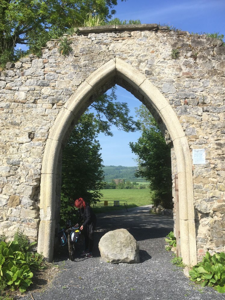
We soon settled into a rhythm and Carlow town fell quietly behind us. As we rolled on south, so too did the Barrow, slowly gathering girth. The path here is wide, grassy and well-kept. We passed a couple of gents out power-walking, and exchanged pleasantries of the day, and as we were stopping roughly every 5k or so, they passed us again as we swigged from our water bottles and chewed jelly babies. The archway above no doubt once led on to great things. That morning, for us, it simply marked the fork in the road were current events forced us off the bank and onto the public highways of Carlow. No matter. We were soon back Barrow-side again. And Leighlinbridge was our next stop. As we stocked up on yet more Lucozade and other goodies, the two fit gents appeared, gave a hearty wave, turned around and headed back again. Clearly they were on a mission. And a fine day for a mission it was too.


As with all river crossings, this one too was guarded jealously in its day. The crossing or fording of a river has always been important since time immemorial, and Ireland is no different. The Irish word for a ford is áth, and this pops up in many place names. Athy, where we were yesterday, for a start. Possibly the best known is the capital city. Of course, that is Dublin, which derives from dubh (black) and linn (pool), or the spot where the small River Poddle joined the Liffey. But before the Vikings arrived in Ireland, locals were crossing the wide and marshy river estuary for generations. And to do this, they made woven hazel panels (wattles) and staked them into the mud to create a passage at low tide. No doubt replacing those ‘hurdles’, as they were known, was a shitty job for someone. So, Dublin was originally the Town of the Ford of the Hurdles, or Báile Átha Cliath.
(Whilst I’m rambling, let me ramble some more in relation to place-names. As a Leixlip native, I am always proud to relate the history of our town, with its Viking influence. Lax hlaup, as any modern Dane or Norwegian will tell you, still translates as Salmon Leap. Or Léim an Bhradáin, in Irish. But which came first? Surely the natives had the drop on that, and recounted the name to the tourists, just as Dubs would have called the black pool at the Poddle’s mouth Dubh Linn before the Vikings arrived. The Vikings were the ones to transliterate, just as the English would do many times over with many other Irish place-names (often with unusual results). So I think we are selling ourselves a little short when we choose to credit the naming of some places after our foreign friends. After all, the Vikings would have used Norse words to say Black Pool, but instead chose to pronounce it phonetically (Dyflinn), after the Irish. And I believe the same thing happened in Leixlip. Occam’s Razor, in other words.)
The Barrow is a wide and relatively deep river, and so any crossing was going to be important, not just for trade and commerce, but also for security in a time of violence. The original crossings would have been, in some cases, fords, where the river was shallow, and then wooden bridges, before finally stone was used. There are some fine bridges along the Barrow, without doubt. Goresbridge has nine arches, for example. And at every crossing, there was usually a fortification, and at Leighlinbridge, that fort is called Black Castle. I grew up in a house called Black Castle, and indeed it would have been a 16th century tower house in its day, and most likely stood on the grounds of an earlier Anglo-Norman fort of some description. Today, the Black Castle I know has had a storey removed, and various alterations and amendments to domesticate its more defensive origins. But the thick, outer walls are always a reminder of its purpose. The ‘other’ Black Castle we were looking at now though had clearly seen better days.
So, yes. Running. The stretch after Leighlinbridge to Goresbridge was a good 15k or so, on top of the 11 we had already clocked up from Carlow. The sun climbed and we toiled. Well, I suppose it would be fair to say that S, on the bike, was having a different experience. That is down to her back trouble (the downside) and the bike (an upside).


Between these two towns is Bagenalstown, or Mhuine Bheag, as some folks call it. There is a story there too, but you can fish it out yourselves, ya lazy bums. Needless to say, we’re on the Barrow, so there are wealthy landlords involved, and some fine buildings, many of which are now sadly deserted.
On the road again, out past Bagenalstown, and I can feel the backs of my calves are starting to have conversations. There appear to be mutterings of a work-to-rule, and strike action is a possibility. I send an envoy down with promises of rest, Lucozade and possibly even a dip in the cool river waters. It does little to resolve the impasse. Instead, the knees hear of the mutiny, and decide to join for better terms and conditions. We reach Slyguff Lock and take a break. I root around in the panniers, searching for my brave face. I point out the sign and make light of the English translation.
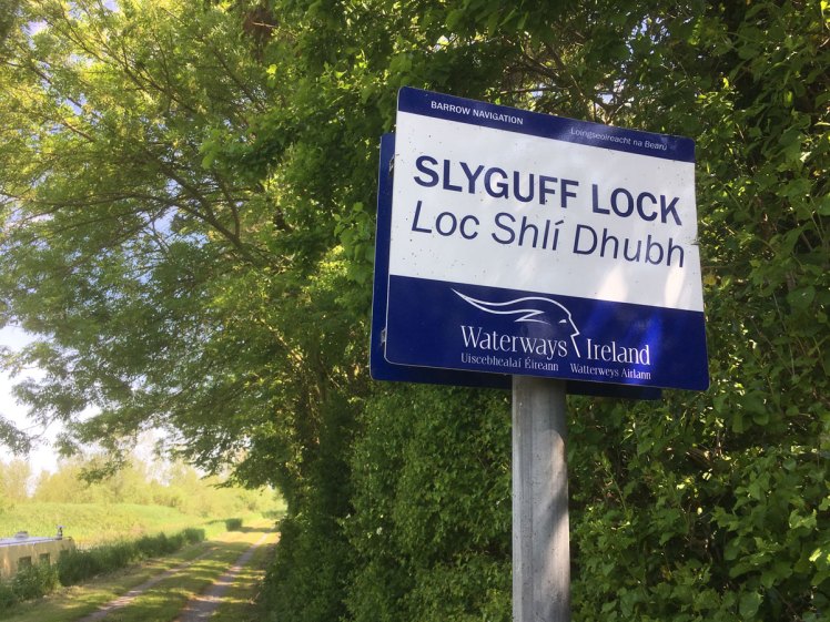
“Look”, I say to S. “This place is called Slyguff! We’re in sneaky fartland…”
S isn’t in on the gag though. Why is that funny? I explain that, as kids, ‘guff’ was another word for fart. So a sly guff would be a sneaky fart… My brain clearly thought this was hilarious, but perhaps delirious was closer to the truth. In any case, there was no point denying the discomfort. I had already taken one Difene with my breakfast back at the hotel, so I took another, plus a caffeine gel, and lowered myself gently into the lock to cool my angry knees. We set off again and within minutes, pain was shooting up the right leg. I was making all sorts of ugly, gurning faces, but S tended to stay behind me (to allow me to set the pace), so she was blissfully unaware of the potential for a show-stopping injury.
There was nothing for it but to nurse it, keep moving, and hope the various drugs would kick in and allow me to keep running. By Goresbridge, things had settled into something of a stalemate. We took another break and found a garage selling ice-cream. Another power-picnic under the shade of a tree overlooking the Barrow was just the balm we needed. We set off, with batteries if not fully recharged, then at least more than halfway there. The next stretch to Graiguenamanagh would be another 15k or thereabouts, and would definitely test the power of Difene to the max. And the power of pig-headedness too.


As we pottered on towards our destination, the beautiful simplicity of the journey was starting to take hold. This is a simple but powerful phenomenon whereby the minutiae of life get burned off by the basic needs of getting from A to B, finding food and drink, and having rest. I think it does the brain (body and soul) good to every now and again fast from the over-consumption of life. Now that’s not to say we were drinking from the river, and hunting rabbits in the woods. Clearly we were well-catered for, and between the Lucozade, jelly babies and gels, we were carrying enough sugar to kill a racehorse.
Nor did we eschew our mobile phones on this journey. I’m not trying to over-sell the experience, and indeed, in comparison to some real wilderness voyages of discovery, this was very much like my time spent at Slyguff Lock; I was just dipping and out of the Barrow Way for a time. I was never fully immersed.
It was good to let the mind wander as we wove along the meandering river. Not too far, of course, as the gag goes; let your mind wander too far and it may not return! But in this case, I was trying to visualise the river as it might have been hundreds of years ago, before we tried to tame its banks and harness its rolling power for trade and commerce. To the left of the path we were on, there were large areas of marsh and wetland, thick with reeds, buttercups and marsh marigold. No doubt the main river channel would have been flanked with quite impenetrable scrub woodland and wetland, alive with birds and insects. And that would have added to the problem of crossing such a river. Locals developed the Barrow Cot, a small wooden boat not unlike the curragh. It was perfect for shallow waters, and fishing, and no doubt popping over to see your neighbours.
And the other thing the mind does when it’s wandering is hum a tune, of course. Every holiday we’ve ever had has its soundtrack. This is usually down to whatever CD is in the car, and it gets played over and over again. Well, there was no car now, obviously, nor did we bring a CD player with us. But for some bizarre reason, the song we both had lodged in our ears was this one: https://www.youtube.com/watch?v=bflkeWVTNk0
I’m just going to leave that there for now, and quietly move on…
The miles clicked away, and we approached Graiguenamanagh. Some kindly soul predicted that at about this point, you really needed to know how far away this pretty Kilkenny village is, so they painted a clue on the rocks…

The watch gave a cough, so I recorded the distance up to that point, and reset it. Shortly after, it died, then briefly sputtered into life, and then died again. We pulled into Graig (as the locals call it) and spied a wonderful-looking café. Alas, it was closed and up for sale. Maybe if this Barrow Way gets the ‘upgrade’ that some folks are looking for, these places will do enough trade to stay open. Who knows.
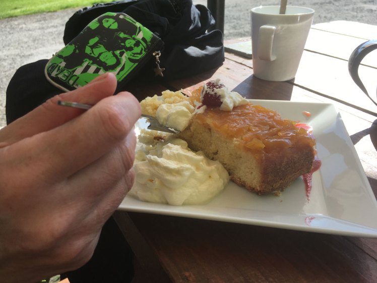
We took a short breather and pushed on. Not far to go now. Indeed, a small matter of 8k according to the guide book. A distance I could easily visualise from the many runs I do in my local park. And a simple mental trick I use to cajole my brain on long runs. I even picked it up to a modest four-hour marathon pace. Indeed, it felt good to be actually ‘running’ again, if that doesn’t sound too strange. Yet another lock sign appeared in the distance, but I knew what this one would say before I could read it. This was St. Mullins Lock, and we had arrived. We walked the last half a k or so into the village and found the Muilleachain Café. It was about half-five in the evening, but there was still a nice buzz about the place, and more to the point, they were still open. Tea and cake was a must but not before a promise I had made was fulfilled. I stripped down to my running shorts and got in for a quick swim. It was blissfully cold, but in that short spell, the Barrow did its therapeutic magic and washed away the labours of the day.
We sat outside in the shade and drank tea and ate cake. We’d done it. Whatever ‘it’ was. Something about the journey, not the destination. Something about a voyage of discovery. These are all rather trite, and smack of inspirational posters you see in modern offices, framed somewhere behind a desk and a dying house plant.
If there was a discovery, it was that we found traveling 120k over two days is very doable, even if one of you is running, and the other is on a bike, and that bike is traveling on a towpath that can be quite bumpy; bumps that will play havoc with your bad back.
You discover there is no limit to the amount of Lucozade that you can drink, and that there are places you can get an itch that you just cannot scratch in public on the grounds of common decency and basic hygiene. Also, between Difene and stubbornness, you can put your body through a fair bit of strife and come out the other end in roughly one piece. You can plan these trips to include your wife’s birthday, and not get drowned in a canal somewhere west of Rathangan. Indeed, this may be my greatest achievement!
We wound our way up the hill to find the B&B. And we found much more than a Bed and Breakfast. We found Mulvarra House, and the wonderful Tim and Linda. I am not suggesting that you need to run 120k in order to sample the delights of St. Mullins or the fantastic hospitality of Mulvarra House. Not at all. I would recommend you drive straight there and book in for a few days and instead expend your energies exploring the local scenery afforded by the Blackstairs Mountains and Barrow Valley. You are also not far from New Ross and Waterford, so you are within striking distance of a lot of wonderful places to visit. Not that I need to remind the hospitality industry in the south-east, but a lot of folk pass through here in a hurry to get to west Cork, Kerry, Clare and Galway. Sure, I get it. It’s the picture postcard version of Ireland: The Ring of Kerry, The Cliffs of Moher, Connemara… but don’t overlook the sunny south-east. And do stay in Mulvarra if you are down that way.
A big shout out to Tim and Linda. May your hinges hang straight and true. Thanks to Mags too for the Eton Mess and chocolate cake (you owe us a slice!) and Guten Tag to Udo from Germany, a man who makes time for the good things in life, despite having a demanding job in the tech industry. To Manny and Sol: Run free! Be bold! But do come in at night time…
We loved our brief stay with you. It was the best possible finish to a journey that had at times teetered on the brink of disaster but overall had repaid our persistence with some great memories. And yes, sore arse cheeks for some.

Coda: It’s Saturday morning, and the sun is still shining. The results of yet another fractious abortion referendum are coming in, and it looks like a conclusive YES from the people of Ireland. Now it’s over to the legislature to sift through the emotional wreckage and find passage for whatever bill can be agreed upon. And that will not be easy. Indeed, it may equal the referendum itself in scale, and there will be some full-on hubristic filibustering and toxic rancour in the Dáil. But I suppose on the plus side, it will be in the Dáil, and not on the national airwaves. The whole point of repealing the Eighth was to allow the politicians to do their jobs, and take responsibility for legislating for what many people see as a women’s health issue. Trust seemed to be a factor here. Many people tried to spike the question by saying you cannot trust the government. And often-times, you cannot, and should not.
But this was more about trusting women. And there are some great women in the Dáil at the moment. Maybe we just need to shift our faith in that direction.
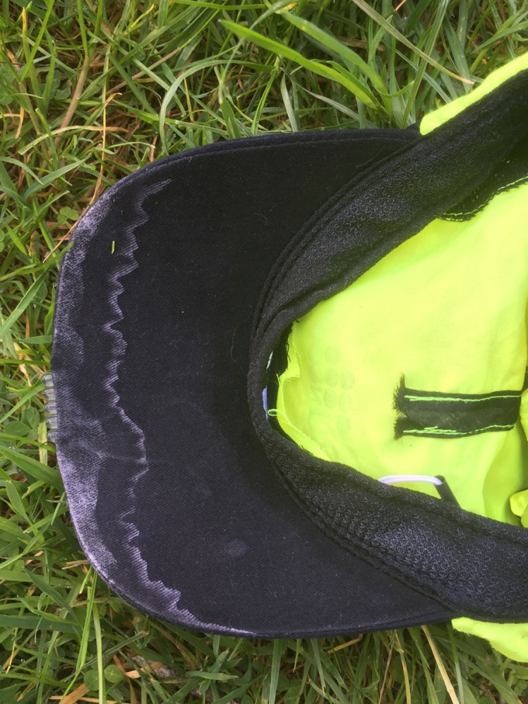
Runners may be vaguely curious about, well, running stuff. I know in fairness I am often curious about details such as fueling strategies and pace, etc. Well, in truth, this was not really one of those runs. It was about getting from one location to another, and enjoying the experience. I chose to wear my Saucony Triumph Isofit Everuns; not because I thought they would be ideal shoes for a canal towpath, but simply because they are the best and most comfortable runners I have ever owned. I wore my Garmin Forerunner 610, but again, I may as well have strapped a piece of bacon to my arm (which I could at least have gnawed on for salt) for all the use it was. A Garmin or similar device for the bike would have made more sense, but we don’t have one. And I wore pretty much what I would wear if I was doing a marathon; proper running shorts and running top. With fine weather, clothing was not an issue really. Though I kept my running hat on to make sure I didn’t get too much sun on top.
And the legs feel okay today. Not quite up for running just yet, but will sneak out for a run tomorrow morning, perhaps. Calves still a bit sore, and the left knee (strangely enough) also a little tender.
S rode the Trek 4 MTB. It’s technically my bike, just with a lowered saddle. With the panniers on board (which started to fall apart after a day; that’s what you get for buying cheap!) it was a heavy old workhorse. But as with the running, this was not really about bikes, tyres, speed, etc. Though on the tyre front, I did swap out the 2″ knobblies for 1.5″ standard tread. That certainly has made the bike run a little smoother.
Would I recommend this trip? Absolutely! You could do it the way we did it, but in fairness, it would make more sense to share the same mode of transport. Walk it together, hike it, cycle it, and if you are really insane, run it. There are plenty of ways to chop it up into bite-size pieces too, and of course, no journey down the Barrow Way would be truly complete until you have rested your weary bones in Mulvarra House B&B.
As I sat out in the sun this morning and read the local paper, I noticed an article on the Royal Canal Greenway, which is being pitched as the longest Greenway in Ireland (when it’s completed). Something in the order of 145k.
Don’t tell S though…

A super read
LikeLiked by 1 person
A super ride… brilliant experience even if my bottom says otherwise. You are amazing❤️
LikeLiked by 1 person
Aw shucks. Mind you, I do hope folks read the post before they read your comment… 😉
LikeLiked by 2 people
Makes me want to visit this area I know very little about I must say! Good to see you on Sunday Btw!
LikeLiked by 1 person
You too. It’s a beautiful part of the country
LikeLiked by 1 person
Especially when it’s so sunny! 🙂
LikeLiked by 1 person
Excellent read – not sure what you do for a living but writing is an option! Well done – love your outlook. Thanks for sharing the journey!
LikeLiked by 1 person
Hi, and thanks for the kind words. I have two jobs: mostly I am found behind the desk in my home office as a freelance graphic designer, and then when the alerter goes off, I run across the road to the fire station and become a firefighter. And when either of those jobs leave me alone long enough, I get out for a run (or a swim, or a cycle…)
LikeLike